
IMAGES TAKEN NEAR TO
Priors Hill Road, ALDEBURGH, IP15 5EP
Introduction
This page details the photographs taken nearby to Priors Hill Road, IP15 5EP by members of the Geograph project.
The Geograph project started in 2005 with the aim of publishing, organising and preserving representative images for every square kilometre of Great Britain, Ireland and the Isle of Man.

There are currently over 7.5m images from over14,400 individuals and you can help contribute to the project by visiting https://www.geograph.org.uk
Image Map
Images are licensed for reuse under creativecommons.org/licenses/by-sa/2.0
Notes
- Clicking on the map will re-center to the selected point.
- The higher the marker number, the further away the image location is from the centre of the postcode.
Image Listing (63 Images Found)
Images are licensed for reuse under creativecommons.org/licenses/by-sa/2.0
Image
Details
Distance
1

Dolphin House - on the outskirts of Aldeburgh
A couple of years younger than the nearby Image, but built by the same architect, and also Grade II listed https://historicengland.org.uk/listing/the-list/list-entry/1269719 & https://britishlistedbuildings.co.uk/101269719-dolphin-house-aldeburgh in 1974.
Image: © Richard Law
Taken: 21 May 2025
0.01 miles
2
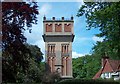
Water Tower
Water Tower in Aldeburgh viewed from the east.
Image: © David Squire
Taken: 21 May 2006
0.03 miles
3

Sandhill - a fine house on the outskirts of Aldeburgh
Sandhill was built in 1924 to a design by the architect Oliver Hill, and attracted a Grade II listing https://historicengland.org.uk/listing/the-list/list-entry/1269720 & https://britishlistedbuildings.co.uk/101269720-sandhill-aldeburgh 50 years later in 1974.
Image: © Richard Law
Taken: 21 May 2025
0.03 miles
4
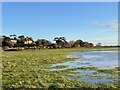
Houses on Priors' Hill Road
Looking south-east from the public footpath across Aldeburgh Marshes.
Image: © Simon Mortimer
Taken: 4 Dec 2021
0.06 miles
5
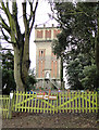
Water tower at the rear of Aldeburgh Hospital
Image: © Adrian S Pye
Taken: 26 Feb 2011
0.06 miles
6
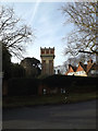
Aldeburgh Water Tower off Park Road
The original water tower was built in the early 1870’s as aload-bearing brick structure to carry a tank of 11,000 gallons of water. Subsequently the water tower was significantly altered in 1909 to increase the capacity of the tank to 35,000 gallons.
At this stage the internal steel frame comprising four large steel columns, along with the internal stair and associated framing was added to support the new enlarged tank and the new corbelled brick enclosure around it.
http://apps3.suffolkcoastal.gov.uk/planningonlinedocuments/125668_7.pdf
Image: © Geographer
Taken: 3 Feb 2015
0.06 miles
7
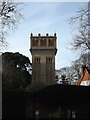
Aldeburgh Water Tower off Park Road
The original water tower was built in the early 1870’s as aload-bearing brick structure to carry a tank of 11,000 gallons of water. Subsequently the water tower was significantly altered in 1909 to increase the capacity of the tank to 35,000 gallons.
At this stage the internal steel frame comprising four large steel columns, along with the internal stair and associated framing was added to support the new enlarged tank and the new corbelled brick enclosure around it.
http://apps3.suffolkcoastal.gov.uk/planningonlinedocuments/125668_7.pdf
(Close up)
Image: © Geographer
Taken: 3 Feb 2015
0.06 miles
8
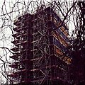
Trig Point Aldeburgh Water Tower
Aldeburgh Water Tower, two trig points at this location Secondary Bolt and 3rd order station at towers centre.
Image: © Cud05
Taken: 24 Mar 2016
0.07 miles
9
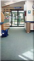
Entrance of Aldeburgh Community Hospital
Off Park Road
https://www.nhs.uk/Services/hospitals/Overview/DefaultView.aspx?id=98537
Image: © Geographer
Taken: 27 Jun 2018
0.08 miles
10
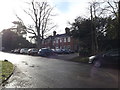
Aldeburgh Community Hospital
Off Park Road at the junction with Park Lane
Image: © Geographer
Taken: 3 Feb 2015
0.08 miles