
IMAGES TAKEN NEAR TO
Roding Lane South, ILFORD, IG4 5PZ
Introduction
This page details the photographs taken nearby to Roding Lane South, IG4 5PZ by members of the Geograph project.
The Geograph project started in 2005 with the aim of publishing, organising and preserving representative images for every square kilometre of Great Britain, Ireland and the Isle of Man.

There are currently over 7.5m images from over14,400 individuals and you can help contribute to the project by visiting https://www.geograph.org.uk
Image Map
Images are licensed for reuse under creativecommons.org/licenses/by-sa/2.0
Notes
- Clicking on the map will re-center to the selected point.
- The higher the marker number, the further away the image location is from the centre of the postcode.
Image Listing (9 Images Found)
Images are licensed for reuse under creativecommons.org/licenses/by-sa/2.0
Image
Details
Distance
1
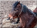
View of a horse in a private paddock on Roding Lane South
Looking west.
Image: © Robert Lamb
Taken: 21 Feb 2021
0.07 miles
2
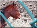
View of a horse in a private paddock on Roding Lane South #2
Looking west.
Image: © Robert Lamb
Taken: 21 Feb 2021
0.09 miles
3
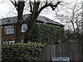
View of a house with ivy growing on it from Roding Lane South
Looking north-northeast.
Image: © Robert Lamb
Taken: 21 Feb 2021
0.10 miles
4
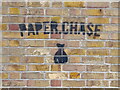
View of Paper.Chase street art on the front of a former shed on Woodford Bridge Road
Looking north.
Image: © Robert Lamb
Taken: 21 Feb 2021
0.16 miles
5
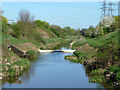
Weir on River Roding
This section of river in a cutting is artificial and bypasses a meander to the left. It was dug when the roads associated with the southern end of the M11 were built.
Image: © Robin Webster
Taken: 9 Apr 2011
0.18 miles
6
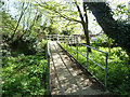
Footbridge to Roding Lane South
This is on the 'dry' side of the east bank of the River Roding, and appears to cross a fragment of the natural river course before it was straightened.
Image: © Robin Webster
Taken: 9 Apr 2011
0.20 miles
7
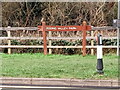
View of the wooden Roding Valley Park entrance sign on Roding Lane South
Looking west.
Image: © Robert Lamb
Taken: 21 Feb 2021
0.20 miles
8
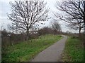
Roding Valley Park
This area of former floodplain by the River Roding was designated a linear park after construction of the M11. It provides a pleasant north-south leisure route alongside the rather sluggish Roding. The new tree planting will in time screen the motorway, which has a roar like a jumbo jet. Here we are looking north, with the river to our right and the motorway on the left. Redbridge roundabout is half a mile behind us.
Image: © John Davies
Taken: 21 Dec 2005
0.21 miles
9
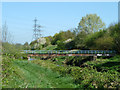
Footbridge over River Roding
A route to Roding Lane South on the east side of the river.
Image: © Robin Webster
Taken: 9 Apr 2011
0.22 miles