
IMAGES TAKEN NEAR TO
Guildford Road, ILFORD, IG3 9YB
Introduction
This page details the photographs taken nearby to Guildford Road, IG3 9YB by members of the Geograph project.
The Geograph project started in 2005 with the aim of publishing, organising and preserving representative images for every square kilometre of Great Britain, Ireland and the Isle of Man.

There are currently over 7.5m images from over14,400 individuals and you can help contribute to the project by visiting https://www.geograph.org.uk
Image Map
Images are licensed for reuse under creativecommons.org/licenses/by-sa/2.0
Notes
- Clicking on the map will re-center to the selected point.
- The higher the marker number, the further away the image location is from the centre of the postcode.
Image Listing (27 Images Found)
Images are licensed for reuse under creativecommons.org/licenses/by-sa/2.0
Image
Details
Distance
1
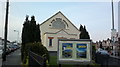
View of South Park Chapel from Ripley Road
Looking north-northeast.
Image: © Robert Lamb
Taken: 28 Mar 2014
0.08 miles
2
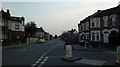
View down Water Lane from outside South Park Chapel
Looking south-southwest. South Park Primary School can be seen to the right.
Image: © Robert Lamb
Taken: 28 Mar 2014
0.12 miles
4

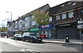
Maplin Store on Green Lane
Usually you would find a Maplin store on either a high street or out-of-town retail park, but the Ilford store is located on a residential main road, where there is a parade of shops just a few hundred yards up the road in the photo. The store can be found on the junction of A1083 Green Lane and South Park Drive, which is out of shot behind and to the right of the photographer. View taken looking south-south east from Green Lane.
Image: © Robert Lamb
Taken: 30 Aug 2008
0.13 miles
5
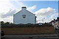
Green Lane, Seven Kings
Crown Autohub is behind the wall. Car sales.
Image: © David Howard
Taken: 9 May 2021
0.14 miles
6
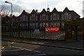
South Park School.
This is South Park Primary School in Water Lane Ilford. It was opened in August 1913
Image: © Glyn Baker
Taken: 14 Apr 2006
0.14 miles
7
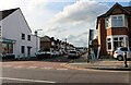
Haslemere Road at the junction of Green Lane
Image: © David Howard
Taken: 9 May 2021
0.15 miles
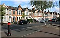
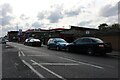
10
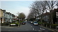
View of Morrab Gardens from Water Lane
Morrab Gardens is quite a stark contrast to surrounding roads as it is part of the Mayfield Conservation Area. Looking north-northeast.
Image: © Robert Lamb
Taken: 28 Mar 2014
0.17 miles