
IMAGES TAKEN NEAR TO
Hainault Bridge Parade, Hainault Street, ILFORD, IG1 4GF
Introduction
This page details the photographs taken nearby to Hainault Bridge Parade, Hainault Street, IG1 4GF by members of the Geograph project.
The Geograph project started in 2005 with the aim of publishing, organising and preserving representative images for every square kilometre of Great Britain, Ireland and the Isle of Man.

There are currently over 7.5m images from over14,400 individuals and you can help contribute to the project by visiting https://www.geograph.org.uk
Image Map
Images are licensed for reuse under creativecommons.org/licenses/by-sa/2.0
Notes
- Clicking on the map will re-center to the selected point.
- The higher the marker number, the further away the image location is from the centre of the postcode.
Image Listing (107 Images Found)
Images are licensed for reuse under creativecommons.org/licenses/by-sa/2.0
Image
Details
Distance
1
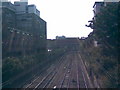
Railway outside Ilford Station
The railway cuts through Ilford Town Centre in a cutting, which burrows underneath the Exchange Mall, before arriving at Ilford station. The two tracks on the left are for fast trains from Liverpool Street to Southend Victoria, Essex and East Anglia, whilst the two tracks on the right handle the suburban services between Liverpool Street and Shenfield (with an occasional train to Southminster). View taken from the Hainault Street bridge, looking towards Ilford Station. The Ilford Exchange is in the centre of the photo, whilst above and beyond that is the BT tower on Ilford Hill.
Image: © Robert Lamb
Taken: 30 Aug 2008
0.03 miles
2
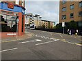
Havelock Street Junction with Hainault Street, Ilford
AS there is a nearby pub called The General Havelock, I assume the Street is named after Major General Sir Henry Havelock KCB (5 April 1795 – 24 November 1857), a British general who is particularly associated with India and his recapture of Cawnpore during the Indian Rebellion of 1857 (First War of Independence, Sepoy Mutiny).
Image: © Richard Rogerson
Taken: 27 Oct 2021
0.03 miles
3
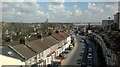
View over Ilford from the Exchange Shopping Centre multi-storey car park #2
This a slight pan south from Image The road leading away from the camera is Ley Street. The large white building on the right is the multi-storey car park for bus drivers starting their shifts at the bus stand on Hainault Street. Looking east-northeast.
Image: © Robert Lamb
Taken: 14 Mar 2013
0.04 miles
4
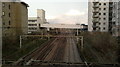
View of the Greater Anglia railway towards Shenfield from Hainault Street
Looking north-northeast. Griggs Approach crosses the railway on the concrete flyover in the background.
Image: © Robert Lamb
Taken: 25 Feb 2014
0.04 miles
5
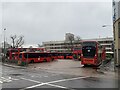
Ilford Bus Station/Depot
Ilford Bus Station/Depot
Multi storey Car Park in the background.
Image: © Gita Patel
Taken: 8 Jan 2022
0.05 miles
6
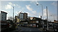
View of Vector Point and Pioneer Point from Ley Street
Looking south-southwest.
Image: © Robert Lamb
Taken: 5 Feb 2014
0.05 miles
7
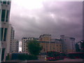
Hainault Street bus station from Hainault Street
This is a response to Andrew Dann's Image, taken from Hainault Street and looking towards the railway (behind the buildings in the background). All the buildings you see in the background have only been built over the course of this decade - I think the silver and peach building was built in 2004 and the others behind it throughout 2005 and 2006. The building on the extreme left in the foreground, however, is a multi-storey car park and part of the bus station operations and has been there for as long as I can remember. The bus station is only just inside the left edge of the square, so it may be possible I may be looking at the bus station from square TQ4386, but I'm not quite sure.
Image: © Robert Lamb
Taken: 19 Aug 2008
0.05 miles
8
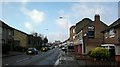
View of the Exchange multi-storey car park and Mill House from Ley Street
Looking south-southwest. Mill House is BT's office block on Ilford Hill, just on the other side of the town centre.
Image: © Robert Lamb
Taken: 5 Feb 2014
0.05 miles
9
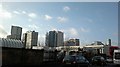
View of the Ilford skyline from Ley Street
From left to right, Raphael House, Lynton House, Centreview Apartments, the Ilfomation office block and Spectrum Towers. The long white building in front of these is the multi-storey car park for the bus station and peeking above these are the old Harrison and Gibson department store building and Pioneer Point. Looking south-southwest.
Image: © Robert Lamb
Taken: 5 Feb 2014
0.06 miles
10
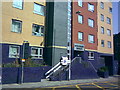
Spectrum Towers, Hainault Street
This is the first of three tower blocks (constructed in 2006) which have been created in Ilford town centre. It's called Spectrum Towers, and is located on the left side of Hainault Street immediately after the railway bridge. View taken looking north-northeast from Hainault Street at the junction of Station Road.
Image: © Robert Lamb
Taken: 30 Aug 2008
0.07 miles