View of the Ilford skyline from Ley Street
Introduction
The photograph on this page of View of the Ilford skyline from Ley Street by Robert Lamb as part of the Geograph project.
The Geograph project started in 2005 with the aim of publishing, organising and preserving representative images for every square kilometre of Great Britain, Ireland and the Isle of Man.

There are currently over 7.5m images from over 14,400 individuals and you can help contribute to the project by visiting https://www.geograph.org.uk
View of the Ilford skyline from Ley Street
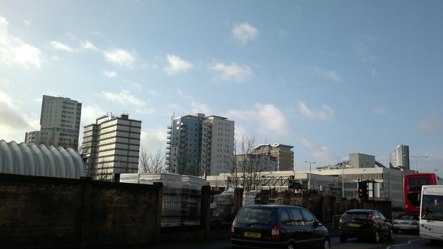
Image: © Robert Lamb Taken: 5 Feb 2014
From left to right, Raphael House, Lynton House, Centreview Apartments, the Ilfomation office block and Spectrum Towers. The long white building in front of these is the multi-storey car park for the bus station and peeking above these are the old Harrison and Gibson department store building and Pioneer Point. Looking south-southwest.
Images are licensed for reuse under creativecommons.org/licenses/by-sa/2.0
Image Location
Latitude
51.560159
Longitude
0.076796