
IMAGES TAKEN NEAR TO
Connaught Road, ILFORD, IG1 1QT
Introduction
This page details the photographs taken nearby to Connaught Road, IG1 1QT by members of the Geograph project.
The Geograph project started in 2005 with the aim of publishing, organising and preserving representative images for every square kilometre of Great Britain, Ireland and the Isle of Man.

There are currently over 7.5m images from over14,400 individuals and you can help contribute to the project by visiting https://www.geograph.org.uk
Image Map
Images are licensed for reuse under creativecommons.org/licenses/by-sa/2.0
Notes
- Clicking on the map will re-center to the selected point.
- The higher the marker number, the further away the image location is from the centre of the postcode.
Image Listing (102 Images Found)
Images are licensed for reuse under creativecommons.org/licenses/by-sa/2.0
Image
Details
Distance
1
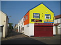
Ilford: Connaught Lane
This colourful building is at the junction of Connaught Lane, stretching away to the left, and Connaught Road in the foreground. Connaught Lane is a thoroughfare that runs parallel to the High Road and St Mary's Avenue and between them.
Image: © Nigel Cox
Taken: 25 Apr 2011
0.03 miles
2
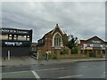
Ilford Spiritualist Church
The High Road offers a wide range of places of worship - Church of England, Roman Catholic, Baptist, Spiritualist, Pentecostal and Evangelical all within a kilometre. The 1946 OS map shows this as a Unitarian church, so it has changed denomination at some time since then. It was built in 1909.
Image: © Stephen Craven
Taken: 30 May 2022
0.03 miles
3
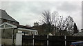
View of St Peter and Paul Church from Green Lane
Looking north-northeast.
Image: © Robert Lamb
Taken: 31 Jan 2014
0.06 miles
4
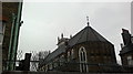
View of St Peter and Paul Church from Connaught Lane
Looking north-northwest.
Image: © Robert Lamb
Taken: 30 Jan 2014
0.06 miles
5
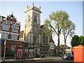
Ilford: Roman Catholic Church of St Peter and St Paul
The church, which is on the south side of the A118 High Road, was built in 1898 in the Perpendicular style. It is a Locally Listed Building and the London Borough of Redbridge web page giving more architectural details is here http://www.redbridge.gov.uk/cms/planning_land_and_buildings/building_control/building_conservation/locally_listed_buildings/church_of_st_peter__st_paul.aspx
The Church's website is here http://www.ssppilford.org.uk/
Image: © Nigel Cox
Taken: 25 Apr 2011
0.06 miles
6
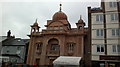
View of the Karamsar Gurdwara from High Road, Ilford
Easily the most elegant building on this whole stretch of road! If you look closely, you can see it's strung with blue LED lights, which I think it is all year round. Looking south-southeast.
Image: © Robert Lamb
Taken: 29 Jan 2014
0.06 miles
7
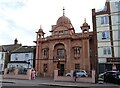
Gurdwara Karamsar, Ilford
Sikh temple on High Road, Ilford.
Image: © JThomas
Taken: 22 Aug 2022
0.07 miles
8
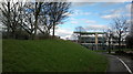
View of St Peter and Paul Church from the Philpot Path
Looking north-northeast.
Image: © Robert Lamb
Taken: 7 Feb 2014
0.07 miles
9
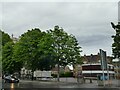
Cardinal Heenan Centre, Ilford High Road
The High Road offers a wide range of places of worship - Church of England, Roman Catholic, Baptist, Spiritualist, Pentecostal and Evangelical all within a kilometre. The 1962 OS map shows the older building behind as St Peter & St Paul's School, obviously connected to the church of the same name whose tower can be seen over the trees to the left Image Along with the prefabricated building in the former playground it now forms a community centre.
Image: © Stephen Craven
Taken: 30 May 2022
0.09 miles
10
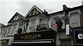
View of a cart and two barrels above Oberza cafe on High Road, Ilford
Oberza has only opened very recently, as it is called "7even" in the Google Streetview from November 2012: https://goo.gl/maps/FSGV7aFB3xPG6M2U7 . The barrels have been there for about two years but the cart is a recent addition. Looking north-northwest.
Image: © Robert Lamb
Taken: 29 Jan 2014
0.09 miles