
IMAGES TAKEN NEAR TO
High Road, ILFORD, IG1 1QE
Introduction
This page details the photographs taken nearby to High Road, IG1 1QE by members of the Geograph project.
The Geograph project started in 2005 with the aim of publishing, organising and preserving representative images for every square kilometre of Great Britain, Ireland and the Isle of Man.

There are currently over 7.5m images from over14,400 individuals and you can help contribute to the project by visiting https://www.geograph.org.uk
Image Map
Images are licensed for reuse under creativecommons.org/licenses/by-sa/2.0
Notes
- Clicking on the map will re-center to the selected point.
- The higher the marker number, the further away the image location is from the centre of the postcode.
Image Listing (124 Images Found)
Images are licensed for reuse under creativecommons.org/licenses/by-sa/2.0
Image
Details
Distance
1
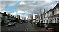
View of the Ilford skyline from Richmond Road #2
Taken from further along the road, at the junction of Albert Road, looking north-northwest.
Image: © Robert Lamb
Taken: 4 Feb 2014
0.02 miles
2
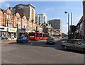
High Road, Ilford IG1 looking east beyond pedestrianised area
Image: © John Salmon
Taken: 9 Apr 2007
0.03 miles
3
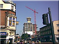
New block of flats in Ilford Town Centre
Yet another block of flats being constructed in Ilford! Two have already been constructed over the last 2-3 years just out of shot to the left in this image, straddling the railway and one of which, Spectrum Towers, I have photographed here on Geograph! This shot was taken in range of John Salmon's image of the High Road, and is taken looking east down the said road from the junction with Hainault Street.
Image: © Robert Lamb
Taken: 30 Aug 2008
0.03 miles
4
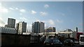
View of the Ilford skyline from Ley Street
From left to right, Raphael House, Lynton House, Centreview Apartments, the Ilfomation office block and Spectrum Towers. The long white building in front of these is the multi-storey car park for the bus station and peeking above these are the old Harrison and Gibson department store building and Pioneer Point. Looking south-southwest.
Image: © Robert Lamb
Taken: 5 Feb 2014
0.04 miles
5
View of Raphael and Lynton Houses from Green Lane
Looking west.
Image: © Robert Lamb
Taken: 20 Feb 2014
0.04 miles
6
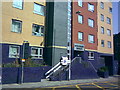
Spectrum Towers, Hainault Street
This is the first of three tower blocks (constructed in 2006) which have been created in Ilford town centre. It's called Spectrum Towers, and is located on the left side of Hainault Street immediately after the railway bridge. View taken looking north-northeast from Hainault Street at the junction of Station Road.
Image: © Robert Lamb
Taken: 30 Aug 2008
0.04 miles
7
View of Raphael and Lynton Houses from the Philpot Path #2
Looking north-northwest.
Image: © Robert Lamb
Taken: 5 Feb 2014
0.04 miles
8
View of Raphael House from Green Lane
Looking west.
Image: © Robert Lamb
Taken: 20 Feb 2014
0.05 miles
9
View of the Ilford skyline from the Philpot Path
Looking north-northwest across the Winston Way Roundabout.
Image: © Robert Lamb
Taken: 5 Feb 2014
0.05 miles
10
View of the Ilford skyline from Woodlands Road
Looking north-northeast.
Image: © Robert Lamb
Taken: 5 Feb 2014
0.05 miles