
IMAGES TAKEN NEAR TO
Station Parade, BARKING, IG11 8TU
Introduction
This page details the photographs taken nearby to Station Parade, IG11 8TU by members of the Geograph project.
The Geograph project started in 2005 with the aim of publishing, organising and preserving representative images for every square kilometre of Great Britain, Ireland and the Isle of Man.

There are currently over 7.5m images from over14,400 individuals and you can help contribute to the project by visiting https://www.geograph.org.uk
Image Map
Images are licensed for reuse under creativecommons.org/licenses/by-sa/2.0
Notes
- Clicking on the map will re-center to the selected point.
- The higher the marker number, the further away the image location is from the centre of the postcode.
Image Listing (160 Images Found)
Images are licensed for reuse under creativecommons.org/licenses/by-sa/2.0
Image
Details
Distance
1
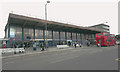
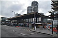
Frontage of Barking station, Station Parade
Pevsner described the station frontage as "commensurably modern in outlook and unquestionably one of the best stations of this date [1959-61]". Tastes have changed since then but at the time its Brutalist architecture enhanced the image of what had (and not for the last time) become an extremely run-down line. Note the absence of the slip-road for buses and taxis that until fairly recently separated the station from the rest of the pavement.
Image: © David Kemp
Taken: 29 Mar 2017
0.00 miles
3
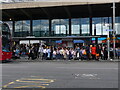
Barking Station Frontage
Outside the station entrance a gaggle of school children (all seemingly with matching pink backpacks) and teachers await a bus.
Image: © John Kingdon
Taken: 1 Aug 2023
0.01 miles
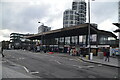
7
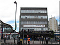
The Barking Dog
An obviously-named pub near the railway station in Barking.
The price of office rentals had not gone up in four years: see Image
The man with the stop-go board was controlling a pedestrian crossing for the Skyride.
Image: © Stephen Craven
Taken: 21 Aug 2011
0.02 miles
8
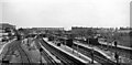
Barking Station
View eastwards showing this major station as it was in 1961. That was not long after the station was comprehensively rebuilt and flyovers and a fly-under had been incorporated to allow ready flow of freight from Ripple Lane Yard and elsewhere down the Tilbury Line to the west and north over the main commuter lines from Fenchurch Street and the District Line. The platforms served (left to right): bay for terminating Kentish Town service, eastbound District (Upminster) Line, bay for terminating Hammersmith & City Line, with beyond a second face for eastbound District Line, Down and Up Southend direct lines, westbound District Line, down Tilbury line with an ex-War Department 2-8-0, and (the other side of the island) up Tilbury Line. The last two served both the Fenchurch Street route and (via a flyove), the route via Woodgrange Park to the rest of the national system. The Fenchurch Street to Tilbury, Southend and Shoeburyness lines were electrified a little over a year later.
Image: © Ben Brooksbank
Taken: 12 May 1961
0.02 miles
9
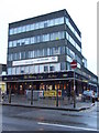
The Barking Dog
The Barking Dog pub in Barking town centre.
Image: © Malc McDonald
Taken: 2 Oct 2010
0.02 miles
10
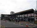
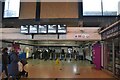
Barking station entrance
The station is on both National Rail and London Underground lines. There are bus stops immediately outside the entrance.
Image: © Stephen Craven
Taken: 21 Aug 2011
0.02 miles