
IMAGES TAKEN NEAR TO
North Street, BARKING, IG11 8FQ
Introduction
This page details the photographs taken nearby to North Street, IG11 8FQ by members of the Geograph project.
The Geograph project started in 2005 with the aim of publishing, organising and preserving representative images for every square kilometre of Great Britain, Ireland and the Isle of Man.

There are currently over 7.5m images from over14,400 individuals and you can help contribute to the project by visiting https://www.geograph.org.uk
Image Map
Images are licensed for reuse under creativecommons.org/licenses/by-sa/2.0
Notes
- Clicking on the map will re-center to the selected point.
- The higher the marker number, the further away the image location is from the centre of the postcode.
Image Listing (78 Images Found)
Images are licensed for reuse under creativecommons.org/licenses/by-sa/2.0
Image
Details
Distance
1

Elevated and ground level tracks at the approach to Barking Station
View from charter train on high level railway track above ground level lines
Image: © Roger Templeman
Taken: 17 Sep 2011
0.02 miles
2
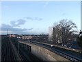
Railway line to Manor Park
As seen from the footbridge between North Street and Loxford Road.
The lines on the left carry the District Line to East Ham (tube-line), the line to Woodgrange Park (the Overground Line), and the railway line to Fenchurch Street.
The line on the right carries the High Speed link to Stratford.
Image: © David Anstiss
Taken: 16 Dec 2012
0.03 miles
3
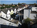
Barking: Tanner Street
Viewed from the footbridge over the railway at the western end of Tanner Street, the minaret of Image is visible on the horizon to the left.
Image: © Nigel Cox
Taken: 30 Oct 2007
0.04 miles
4
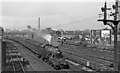
Fenchurch Street - Shoeburyness train approaching Barking
View westward, towards London, from the same bridge as Image but 12½ years earlier, soon after Nationalisation and before the major changes in layout. Still un-renumbered Stanier 3-cylinder 4P 2-6-4T No. 2511 is on ancient stock approaching old Midland signals. (The 3-cylinder 2-6-4Ts were the principal motive-power on the Tilbury Line trains in those days). The Tottenham & Forest Gate lines to/from Kentish Town are on the far side, beyond the LPTB District/Metropolitan tracks.
Image: © Ben Brooksbank
Taken: 25 Sep 1948
0.06 miles
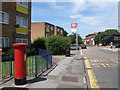
7

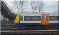
The Jolly Fisherman, North Street, Barking
Image: © Richard Rogerson
Taken: 22 Oct 2009
0.07 miles
8

Northbury Junior and Infant School, Barking
As seen from the footpath near the railway line.
Image: © David Anstiss
Taken: 16 Dec 2012
0.08 miles
9
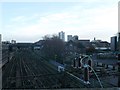
Railway line to Barking
As seen from the footbridge between North Street and Loxford Road.
The lines on the right carry the District Line to Barking (tube-line), the line to Barking Terminus (the Overground Line), and the railway line to Barking.
The line on the left carries the High Speed link from Stratford towards the Channel Tunnel.
In the background is the Northern Relief Road bridge.
Image: © David Anstiss
Taken: 16 Dec 2012
0.08 miles
