IMAGES TAKEN NEAR TO
Tide Street, IG11 7XB
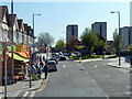
Introduction
This page details the photographs taken nearby to Tide Street, IG11 7XB by members of the Geograph project.
The Geograph project started in 2005 with the aim of publishing, organising and preserving representative images for every square kilometre of Great Britain, Ireland and the Isle of Man.

There are currently over 7.5m images from over14,400 individuals and you can help contribute to the project by visiting https://www.geograph.org.uk
Image Map
Images are licensed for reuse under creativecommons.org/licenses/by-sa/2.0
Notes
- Clicking on the map will re-center to the selected point.
- The higher the marker number, the further away the image location is from the centre of the postcode.
Image Listing (62 Images Found)
Images are licensed for reuse under creativecommons.org/licenses/by-sa/2.0
Image
Details
Distance
1
Ripple Road, Barking
Viewed from a 387 bus.
Image: © Robin Webster
Taken: 9 Apr 2011
0.04 miles
2
St. Margaret's, Barking
St. Margaret's is a road in the Gascoigne housing estate in Barking. In this image, some of the flats have been boarded up, suggesting that they may be facing demolition.
Image: © Malc McDonald
Taken: 21 Oct 2018
0.04 miles
3
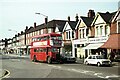
Ripple Road, Barking ? 1978 (2)
This part of London was one of the last strongholds of the classic RT bus type, based at Barking Garage, with RT3321 on its way to Rainham. This section of Ripple Road is not greatly changed in the early 21st century https://www.geograph.org.uk/photo/5948514
This is one of a series of views featuring buses in the 60s, 70s, and 80s. http://www.geograph.org.uk/search.php?i=137652762
Image: © Alan Murray-Rust
Taken: 9 Sep 1978
0.06 miles
4
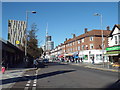
Ripple Road, Barking
Ripple Road in Barking, in East London.
Image: © Malc McDonald
Taken: 21 Oct 2018
0.07 miles
5
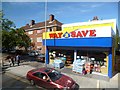
Way 2 Save
Colourful local shop in Ripple Road.
Image: © Des Blenkinsopp
Taken: 4 Jun 2013
0.08 miles
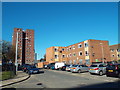
6
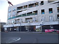
Half finished block on Ripple Road, Barking
Image: © David Howard
Taken: 21 Oct 2017
0.10 miles
8
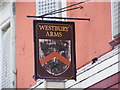
Westbury Arms Public House sign
Off King Edwards Road
Image: © Geographer
Taken: 28 Apr 2009
0.12 miles
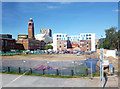
9
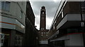
View of Barking Town Hall from the High Street
Looking north-northeast along an alleyway between Iceland and Natwest bank.
Image: © Robert Lamb
Taken: 30 Mar 2015
0.12 miles
10
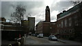
View up Clockhouse Avenue from Broadway
Looking north-northeast. The Town Hall, Barking Learning Centre and Bath House can be seen.
Image: © Robert Lamb
Taken: 30 Mar 2015
0.12 miles