
IMAGES TAKEN NEAR TO
St. Anns, BARKING, IG11 7AH
Introduction
This page details the photographs taken nearby to St. Anns, IG11 7AH by members of the Geograph project.
The Geograph project started in 2005 with the aim of publishing, organising and preserving representative images for every square kilometre of Great Britain, Ireland and the Isle of Man.

There are currently over 7.5m images from over14,400 individuals and you can help contribute to the project by visiting https://www.geograph.org.uk
Image Map
Images are licensed for reuse under creativecommons.org/licenses/by-sa/2.0
Notes
- Clicking on the map will re-center to the selected point.
- The higher the marker number, the further away the image location is from the centre of the postcode.
Image Listing (152 Images Found)
Images are licensed for reuse under creativecommons.org/licenses/by-sa/2.0
Image
Details
Distance
3
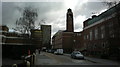
View up Clockhouse Avenue from Broadway
Looking north-northeast. The Town Hall, Barking Learning Centre and Bath House can be seen.
Image: © Robert Lamb
Taken: 30 Mar 2015
0.09 miles
4
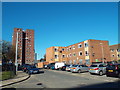
St. Margaret's, Barking
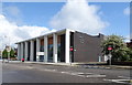
St. Margaret's is a road in the Gascoigne housing estate in Barking. In this image, some of the flats have been boarded up, suggesting that they may be facing demolition.
Image: © Malc McDonald
Taken: 21 Oct 2018
0.10 miles
6
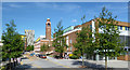
Clockhouse Avenue, Barking
Barking Town Hall is the building with the tower.
Image: © Des Blenkinsopp
Taken: 4 Jun 2013
0.12 miles
7
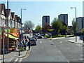
Ripple Road, Barking
Viewed from a 387 bus.
Image: © Robin Webster
Taken: 9 Apr 2011
0.12 miles
8
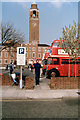
Barking town hall clock tower, 1988
Viewed across a car park taken over for the day by a bus rally, spring 1988. Until recently this area south of the town hall was pleasantly open (although just car parks and roads), but now a similar but more restricted view of this imposing building is only possible through a pedestrian alley between new buildings on the car park.
Image: © Robin Webster
Taken: Unknown
0.12 miles
9
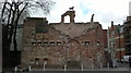
View of the modern ruins from Town Square
Although this looks like a piece of the ruin of Barking Abbey, this is actually a modern decoy installed as part of the Town Square redevelopment in 2007-8 and is intended to represent a piece of Barking's history. Looking north-northwest.
Image: © Robert Lamb
Taken: 30 Mar 2015
0.13 miles
10
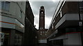
View of Barking Town Hall from the High Street
Looking north-northeast along an alleyway between Iceland and Natwest bank.
Image: © Robert Lamb
Taken: 30 Mar 2015
0.14 miles