
IMAGES TAKEN NEAR TO
Thames Road, BARKING, IG11 0HZ
Introduction
This page details the photographs taken nearby to Thames Road, IG11 0HZ by members of the Geograph project.
The Geograph project started in 2005 with the aim of publishing, organising and preserving representative images for every square kilometre of Great Britain, Ireland and the Isle of Man.

There are currently over 7.5m images from over14,400 individuals and you can help contribute to the project by visiting https://www.geograph.org.uk
Image Map
Images are licensed for reuse under creativecommons.org/licenses/by-sa/2.0
Notes
- Clicking on the map will re-center to the selected point.
- The higher the marker number, the further away the image location is from the centre of the postcode.
Image Listing (8 Images Found)
Images are licensed for reuse under creativecommons.org/licenses/by-sa/2.0
Image
Details
Distance
1
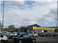
Living Faith Connections, Thames View
This former converted warehouse is on Thames Road.
Now used by the Redeemed Christian Church of God.
Image: © David Anstiss
Taken: 31 Mar 2013
0.08 miles
2
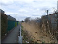
Path to Thames View School, Thames View
This path leads from Thames Road towards Thames View School fields and then onwards to Bastable Avenue.
The path follows beside a reed filled culvert which is also runs parallel to Thames Road. See Image
Image: © David Anstiss
Taken: 31 Mar 2013
0.10 miles
3
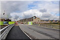
Construction of City East development at Barking Riverside
Photo taken from bridge on Galleons Drive, Barking Riverside. New terraced properties, built by Bellway, are pictured nearing completion.
Image: © Charence Wong
Taken: 13 Oct 2012
0.14 miles
4
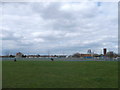
Thames View School Playing fields
The school is on the right. It has one playing field that can not be accessed by nearby residents. The rest of the fields are used as recreational grounds.
Image: © David Anstiss
Taken: 31 Mar 2013
0.15 miles
5
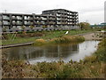
Barking Riverside
Barking Riverside is a huge new 11,000 home development on the old Barking Levels. The land was originally grazing marshes consisting of flat, low-lying grasslands, dissected by ditches and it survived in this form until the 1920s. Much of this has now gone although a few of the ditches and water bodies have been incorporated into the new development as seen here. That is probably the best thing about the development as the 'architecture' is, to be kind, nondescript.
An interesting article about Barking Riverside can be seen at https://www.theguardian.com/cities/2015/aug/17/no-cafe-pub-doctor-londons-most-isolated-suburb-barking-riverside
Image: © Marathon
Taken: 9 Nov 2016
0.18 miles
6
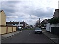
Alderman Avenue, Thames View
As seen from a path between Bastable Avenue and Thames Road.
Image: © David Anstiss
Taken: 31 Mar 2013
0.19 miles
7
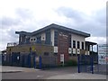
The Sue Bramley Centre, Thames View
This multi-purpose building on Bastable Avenue, contains Thames View library, Neighbourhood Management offices, Youth Support and development services offices, a children's centre and an Adult College of Barking and Dagenham.
The building has been named after a Labour Party Councillor of the Longbridge Ward.
Image: © David Anstiss
Taken: 31 Mar 2013
0.23 miles
8

Thames View Health Centre, Barking
Large doctors clinic on Bastable Avenue.
Image: © David Anstiss
Taken: 31 Mar 2013
0.23 miles