
IMAGES TAKEN NEAR TO
Anchor Close, BARKING, IG11 0GF
Introduction
This page details the photographs taken nearby to Anchor Close, IG11 0GF by members of the Geograph project.
The Geograph project started in 2005 with the aim of publishing, organising and preserving representative images for every square kilometre of Great Britain, Ireland and the Isle of Man.

There are currently over 7.5m images from over14,400 individuals and you can help contribute to the project by visiting https://www.geograph.org.uk
Image Map
Images are licensed for reuse under creativecommons.org/licenses/by-sa/2.0
Notes
- Clicking on the map will re-center to the selected point.
- The higher the marker number, the further away the image location is from the centre of the postcode.
Image Listing (17 Images Found)
Images are licensed for reuse under creativecommons.org/licenses/by-sa/2.0
Image
Details
Distance
1
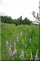
The Ripple
The Ripple is a former ash dump form the now demolished Barkingside Power Station. Nature has reclaimed this industrial wasteland and it is now a Nature Reserve managed by The London Wildlife Trust to find out more see http://www.wildlondon.org.uk/Naturereserves/TheRipple/tabid/141/Default.aspx
There are more pictures at http://www.geograph.org.uk/search.php?i=33781445 or to continue on a virtual tour of Wildlife Trust Reserves in Essex visit Image
Image: © Glyn Baker
Taken: 20 Jun 2009
0.11 miles
2
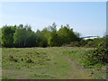
The Ripple Nature Reserve
Waste ground off Renwick Road.
Image: © Robin Webster
Taken: 9 Apr 2011
0.11 miles
3
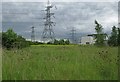
Across The Ripple Reserve
The Ripple is a former ash dump form the now demolished Barkingside Power Station.
The kit in the background is Creekmouth Substation. Nature has reclaimed this industrial wasteland and it is now a Nature Reserve managed by The London Wildlife Trust to find out more see http://www.wildlondon.org.uk/Naturereserves/TheRipple/tabid/141/Default.aspx
Image: © Glyn Baker
Taken: 20 Jun 2009
0.12 miles
4
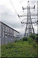
Power & Plants
The plants are in Image Nature Reserve and the buildings are Image Nature has reclaimed this industrial wasteland and it is now a Nature Reserve managed by The London Wildlife Trust to find out more see http://www.wildlondon.org.uk/Naturereserves/TheRipple/tabid/141/Default.aspx
Image: © Glyn Baker
Taken: 20 Jun 2009
0.12 miles
6
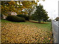
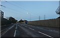
Renwick Road
This leads down to the new Barking Riverside development. At the moment it is not the most inspiring location as a number of other Geographs for this square show. It is not helped by the large number of lorries using the roads.
Image: © Marathon
Taken: 9 Nov 2016
0.18 miles
7
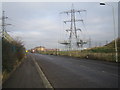
Creekmouth: Renwick Road
The pylons carry high voltage electricity cables to and from the National Grid's Barking Sub-Station, which is on the left side of the road.
Image: © Nigel Cox
Taken: 26 Jan 2007
0.18 miles
8
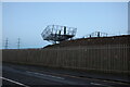
Remains of a pylon by Renwick Road
A year ago a pylon stood here, now only the transformers remain.
Image: © David Howard
Taken: 31 Oct 2020
0.19 miles
9
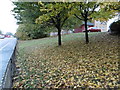
Renwick Road
Renwick Road leads down to the new Barking Riverside development. At the moment it is not the most inspiring location as a number of other Geographs for this square show. It is not helped by the large number of lorries using the roads.
Image: © Marathon
Taken: 9 Nov 2016
0.19 miles
10
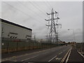
A bleak scene at Barking Riverside
Looking like something out of 'War of the Worlds' and about as bleak, this is Renwick Road, just outside the new Barking Riverside Overground station.
Image: © Marathon
Taken: 3 Nov 2022
0.20 miles