
IMAGES TAKEN NEAR TO
Kings Place, LOUGHTON, IG10 4PW
Introduction
This page details the photographs taken nearby to Kings Place, IG10 4PW by members of the Geograph project.
The Geograph project started in 2005 with the aim of publishing, organising and preserving representative images for every square kilometre of Great Britain, Ireland and the Isle of Man.

There are currently over 7.5m images from over14,400 individuals and you can help contribute to the project by visiting https://www.geograph.org.uk
Image Map
Images are licensed for reuse under creativecommons.org/licenses/by-sa/2.0
Notes
- Clicking on the map will re-center to the selected point.
- The higher the marker number, the further away the image location is from the centre of the postcode.
Image Listing (8 Images Found)
Images are licensed for reuse under creativecommons.org/licenses/by-sa/2.0
Image
Details
Distance
1
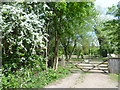
Scene at Loughton
This gate is just off the A121 (High Road) and leads to a field with horses.
Image: © Marathon
Taken: 13 May 2015
0.18 miles
2
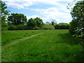
Grassland at North Farm
This small patch of grassland is across High Road (A121) at Loughton from the woodland at Warren Hill.
Image: © Marathon
Taken: 13 May 2015
0.18 miles
3
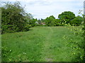
Grassland at North Farm
This small patch of grassland is across High Road (A121) at Loughton from the woodland at Warren Hill.
Image: © Marathon
Taken: 13 May 2015
0.20 miles
4
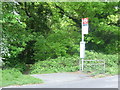
Bus stop for Warren Hill
This is looking across High Road (A121) at Loughton. The path next to the stop leads into the woodland at Warren Hill.
Image: © Marathon
Taken: 13 May 2015
0.22 miles
5
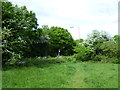
Looking towards the bus stop for Warren Hill
This is looking towards High Road (A121) at Loughton from an area of public grassland near North Farm. The woodland at Warren Hill lies beyond the bus stop.
Image: © Marathon
Taken: 13 May 2015
0.22 miles
6
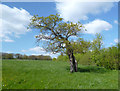
The London Loop near Loughton
On the round London long distance path between Chingford and Chigwell.
Image: © Des Blenkinsopp
Taken: 15 Apr 2014
0.24 miles
7
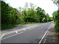
The junction of High Road and Manor Road
This is looking along High Road (A121) towards Loughton at the junction with Manor Road. The latter leads between Powell's Forest and the woodland of Warren Hill to Epping New Road (A104) at the end.
Image: © Marathon
Taken: 13 May 2015
0.24 miles
8
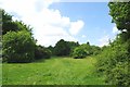
Linder's Field
Linders Field http://www.wildessex.net/sites/Linders%20Field.htm was left in trust to the people of Buckhurst Hill by buisnessman Charles Linder five years before his death in 1957. It is a Local Nature Reserve managed by Epping District Council with the help of Volunteers http://www.eppingforestdc.gov.uk/index.php/component/eventlist/venueevents/14-linder-s-field-local-nature-reserve. The shot is taken looking along one of the public footpaths that cross the reserve.
Image: © Glyn Baker
Taken: 25 May 2017
0.25 miles