
IMAGES TAKEN NEAR TO
Akroyd Lane, HEBDEN BRIDGE, HX7 8TP
Introduction
This page details the photographs taken nearby to Akroyd Lane, HX7 8TP by members of the Geograph project.
The Geograph project started in 2005 with the aim of publishing, organising and preserving representative images for every square kilometre of Great Britain, Ireland and the Isle of Man.

There are currently over 7.5m images from over14,400 individuals and you can help contribute to the project by visiting https://www.geograph.org.uk
Image Map
Images are licensed for reuse under creativecommons.org/licenses/by-sa/2.0
Notes
- Clicking on the map will re-center to the selected point.
- The higher the marker number, the further away the image location is from the centre of the postcode.
Image Listing (76 Images Found)
Images are licensed for reuse under creativecommons.org/licenses/by-sa/2.0
Image
Details
Distance
1
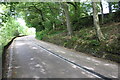
A6033 heading towards Pecket Well at Nab Nook
There is an Ordnance Survey benchmark Image on a stone at the base of the wall at the right hand side of the road about 3m from the right hand edge of the image
Image: © Luke Shaw
Taken: 28 Aug 2017
0.09 miles
2
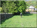
Wallside footpath descending to road (A6033)
Looking westward.
Image: © Peter Wood
Taken: 11 May 2017
0.09 miles
3
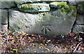
Benchmark on base stone in wall on east side of A6033 at Nab Nook
Ordnance Survey cut mark benchmark described on the Bench Mark Database at www.bench-marks.org.uk/bm87943
Image: © Luke Shaw
Taken: 28 Aug 2017
0.09 miles
4
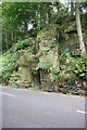
Rock outcrop on east side of A6033 in Galstones Wood
There is an Ordnance Survey benchmark Image on the outcrop in the middle of the image
Image: © Luke Shaw
Taken: 28 Aug 2017
0.10 miles
5
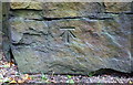
Benchmark on rock outcrop on east side of A6033 in Galstones Wood
Ordnance Survey cut mark benchmark described on the Bench Mark Database at www.bench-marks.org.uk/bm50448
Image: © Luke Shaw
Taken: 28 Aug 2017
0.10 miles
6
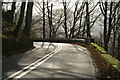
Sharp bend on Keighley Road (A6033)
Between Pecket Well and Hebden Bridge the main road (a former turnpike) was constructed on a narrow shelf cut out of the hillside and descends steeply.
Image: © Phil Champion
Taken: 29 Nov 2006
0.11 miles
7
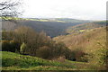
View across Pecket Well Clough towards Heden Dale and Hardcastle Crags
Photo taken from Keighley Road below Pecket Well
Image: © Phil Champion
Taken: 29 Nov 2006
0.11 miles
8
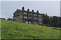
Dwelling near Pecket Well
Beside the A6033, as seen from the Calderdale Way above Spring Wood
Image: © Chris Heaton
Taken: 22 Aug 2017
0.11 miles
9
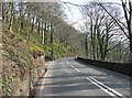
Keighley Road, Wadsworth
Descending from Pecket Well towards Hebden Bridge. Before the lamp post with bus stop there is a small quarry at the side of the road.
Image: © Humphrey Bolton
Taken: 2 Apr 2009
0.14 miles
10
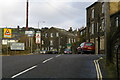
Keighley Road (A6033) at Pecket Bar, Pecket Well
At the junction with the road to Old Town, on the right. The building in the centre of the photo houses Pecket Well College.r.
Image: © Phil Champion
Taken: 29 Nov 2006
0.16 miles