
IMAGES TAKEN NEAR TO
Blue Ball Lane, SOWERBY BRIDGE, HX6 4FL
Introduction
This page details the photographs taken nearby to Blue Ball Lane, HX6 4FL by members of the Geograph project.
The Geograph project started in 2005 with the aim of publishing, organising and preserving representative images for every square kilometre of Great Britain, Ireland and the Isle of Man.

There are currently over 7.5m images from over14,400 individuals and you can help contribute to the project by visiting https://www.geograph.org.uk
Image Map
Images are licensed for reuse under creativecommons.org/licenses/by-sa/2.0
Notes
- Clicking on the map will re-center to the selected point.
- The higher the marker number, the further away the image location is from the centre of the postcode.
Image Listing (65 Images Found)
Images are licensed for reuse under creativecommons.org/licenses/by-sa/2.0
Image
Details
Distance
1

Old milestone
On the south side of the A58, east of Baitings reservoir, the Halifax 7 stone is set well down into the tarmac pavement. But the unusual shape of these Rochdale, Halifax and Ealand turnpike 18C stones can be seen. It is Grade II listed 407766. TW Hanson in his 'The History of Halifax' mentions this road and the milestones.
Image: © Robert Glover
Taken: 5 Nov 2020
0.10 miles
2
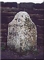
Old Milestone, on the A58, Rochdale Road
E of Baitings reservoir, 15m W of Beestonhirst. Located on the South side of road, in tarmac pavement, back to wall. Carved stone post, 18th century. Alternative view see http://www.geograph.org.uk/photo/6740671
Inscription reads: TO / ROCHDALE / 9 / MILES // TO / HALIFAX / 7 / MILES
Grade II listed by Historic England. see https://historicengland.org.uk/listing/the-list/list-entry/1232399
Milestone Society National ID: YW_HARO07
Image: © Christine Minto
Taken: 31 Jan 2006
0.10 miles
3
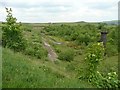
Blackhouse Reservoir, Soyland (Ripponden)
It still has a Yorkshire Water sign at the eastern end, but looks rather disused. Black House is the farm behind the camera. The reservoir became redundant in the early 1990s after the completion of the Ryburn supply scheme.
See Image for an image of the reservoir before it was abandoned.
Image: © Humphrey Bolton
Taken: 5 Jun 2008
0.10 miles
4
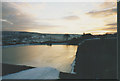
Abandoned reservoir, Blackhouse
Blackhouse Reservoir was an open one, fed from springs, that used to supply Ripponden with drinking water until 1991. The photo was taken after it was decommissioned but before it was drained down.
Update: later photos such as Image show that the dam embankments remain, but the area inside is fast becoming a new woodland.
Image: © Stephen Craven
Taken: 17 Feb 1991
0.11 miles
5
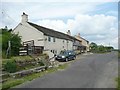
The former Blue Ball Inn, Soyland (Ripponden)
This was on the 18C turnpike road, later superseded by a newly constructed turnpike, the present A58. It survived as a public house into the 1990s. The sign of the blue ball is still there.
Image: © Humphrey Bolton
Taken: 5 Jun 2008
0.12 miles
6
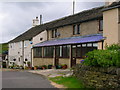
A pub no longer
The former Blue Ball Inn, now a private house.
Image: © John H Darch
Taken: 19 Jun 2009
0.13 miles
7
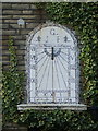
Sundial on New Inn Cottage, formerly a pub of the same name
The motto "Ab hoc Momento pendet Æternitas" translates to "On this moment hangs eternity"
Image: © Alexander P Kapp
Taken: 31 Oct 2008
0.14 miles
8
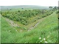
Blackhouse Reservoir from the east, Soyland (Ripponden)
The reservoir was supplied by two springs only. It held about five and a half million gallons when full supplying untreated water to Ripponden and a small part of Sowerby Bridge. The two springs were diverted and piped into nearby Baitings Reservoir when this reservoir was abandoned.
Image: © Humphrey Bolton
Taken: 5 Jun 2008
0.14 miles
9
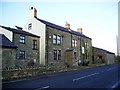
The former New Inn
Has now been divided up into three houses
Image: © Alexander P Kapp
Taken: 31 Oct 2008
0.14 miles
10
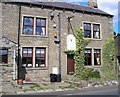
House with sundial
A house on Rochdale Road near Ripponden, this was the New Inn until it closed in 2002 and was converted back into houses.
A close-up of the sundial can be seen in Image
Image: © John Illingworth
Taken: 8 Aug 2007
0.14 miles