Blackhouse Reservoir, Soyland (Ripponden)
Introduction
The photograph on this page of Blackhouse Reservoir, Soyland (Ripponden) by Humphrey Bolton as part of the Geograph project.
The Geograph project started in 2005 with the aim of publishing, organising and preserving representative images for every square kilometre of Great Britain, Ireland and the Isle of Man.

There are currently over 7.5m images from over 14,400 individuals and you can help contribute to the project by visiting https://www.geograph.org.uk
Blackhouse Reservoir, Soyland (Ripponden)
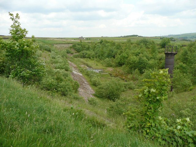
Image: © Humphrey Bolton Taken: 5 Jun 2008
It still has a Yorkshire Water sign at the eastern end, but looks rather disused. Black House is the farm behind the camera. The reservoir became redundant in the early 1990s after the completion of the Ryburn supply scheme. See Image for an image of the reservoir before it was abandoned.
Images are licensed for reuse under creativecommons.org/licenses/by-sa/2.0
Image Location
Latitude
53.670174
Longitude
-1.980286