IMAGES TAKEN NEAR TO
Coronation Street, HALIFAX, HX4 8AP
Introduction
This page details the photographs taken nearby to Coronation Street, HX4 8AP by members of the Geograph project.
The Geograph project started in 2005 with the aim of publishing, organising and preserving representative images for every square kilometre of Great Britain, Ireland and the Isle of Man.

There are currently over 7.5m images from over14,400 individuals and you can help contribute to the project by visiting https://www.geograph.org.uk
Image Map
Images are licensed for reuse under creativecommons.org/licenses/by-sa/2.0
Notes
- Clicking on the map will re-center to the selected point.
- The higher the marker number, the further away the image location is from the centre of the postcode.
Image Listing (183 Images Found)
Images are licensed for reuse under creativecommons.org/licenses/by-sa/2.0
Image
Details
Distance
1
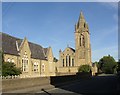
Greetland, West Vale, school and church
The old part of Greetland was strung out along what is now the B6113 to the west. In the late 19C a new town known as West Vale developed in the valley, and a school and church were built (SE097213). The name stems from being at the western end of Elland, although it is at the eastern end of Greetland which was an independent authority only from 1894 to 1937.
Image: © Humphrey Bolton
Taken: Unknown
0.01 miles
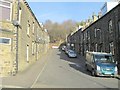
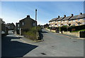
2
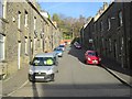
Coronation Street - Clay House Lane
Image: © Betty Longbottom
Taken: 30 Nov 2013
0.02 miles
3
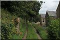
Calderdale Way on Dean End
The long distance path heading for West Vale
Image: © Chris Heaton
Taken: 15 Aug 2021
0.02 miles
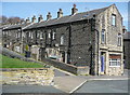
4
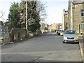
Clay House Lane - looking towards Rochdale Road
Image: © Betty Longbottom
Taken: 30 Nov 2013
0.03 miles
6
Back John Street and a former shop, Clay House Lane
Image: © Humphrey Bolton
Taken: 2 Apr 2015
0.04 miles
7
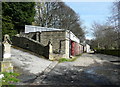
Clay House Lane at the entrance to White Gables
This part of the lane looks to be unadopted, but is Elland FP83 and also part of the Calderdale Way.
Image: © Humphrey Bolton
Taken: 2 Apr 2015
0.05 miles
8
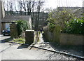
Footpath from Clay House Lane to Rochdale Road
This is Elland FP34.
Image: © Humphrey Bolton
Taken: 2 Apr 2015
0.05 miles
9
Junction of Clay House Lane with Lindwell Avenue
Linwell Street, on the right, is relatively new; it is not on the 1933 edition of the 1:2500 map.
Image: © Humphrey Bolton
Taken: 2 Apr 2015
0.05 miles
10
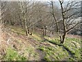
Footpath off Wellgate, Greetland
This is a short cut path up a steep field that is no longer used for agriculture and is turning into a wood. The path is part of the Calderdale Way.
Image: © Humphrey Bolton
Taken: 5 Mar 2013
0.06 miles