IMAGES TAKEN NEAR TO
Hollins, HALIFAX, HX2 6JZ

Introduction

This page details the photographs taken nearby to Hollins, HX2 6JZ by members of the Geograph project.

The Geograph project started in 2005 with the aim of publishing, organising and preserving representative images for every square kilometre of Great Britain, Ireland and the Isle of Man.

There are currently over 7.5m images from over14,400 individuals and you can help contribute to the project by visiting https://www.geograph.org.uk

Image Map


Images are licensed for reuse under creativecommons.org/licenses/by-sa/2.0
Notes
  • Clicking on the map will re-center to the selected point.
  • The higher the marker number, the further away the image location is from the centre of the postcode.

Image Listing (9 Images Found)

Images are licensed for reuse under creativecommons.org/licenses/by-sa/2.0
Image
Details
Distance
1
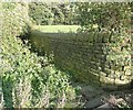
Hollins Lane short cut
The position of lettering for the road name on the 1850 six-inch map implies that it originally went down this steep narrow way, although by then a loop at an easier gradient had been made. It is Sowerby Bridge FP 62.
Image: © Humphrey Bolton Taken: 27 May 2013
0.04 miles
2
Broad Lane
Looking across the corner of a water main interchange area. Shroggs Farm is in the distance.
Image: © Humphrey Bolton Taken: 27 May 2013
0.14 miles
3
Water main interchange, Broad Lane
A fenced-off area with several valve marker posts looking rather like an overgrown graveyard.
Image: © Humphrey Bolton Taken: 27 May 2013
0.14 miles
4
Footpath off Sowerby Lane, Luddenden Foot
Stone steps lead to a tunnel formed by a tree covered by a creeper.
Image: © Humphrey Bolton Taken: 2 Oct 2008
0.16 miles
5
Cricket Club
Cricket Club.
Image: © Peter McDermott Taken: 14 May 2016
0.18 miles
6
Row End, Sowerby Lane, Sowerby
Dated 1627 according to 'Images of England', where the name is given as 'Raw End'. The road is in Sowerby, but the house in Luddenden Foot.
Image: © Humphrey Bolton Taken: 2 Oct 2008
0.19 miles
7
Cat Lane
Image: © Alexander P Kapp Taken: 22 Apr 2009
0.21 miles
8
Brocks, Luddenden Foot
This leads to Luddenden Foot. The area below Sowerby Lane was originally in Sowerby civil parish, but was given to Luddenden Foot Urban District when it was formed in 1894.
Image: © Humphrey Bolton Taken: 2 Oct 2008
0.22 miles
9
Reservoir off Broad Lane
This was the millpond for Higgin Mill (Worsted on the 1659 six-inch map), which was adjacent, facing Acre Lane.
Image: © Humphrey Bolton Taken: 27 May 2013
0.25 miles