IMAGES TAKEN NEAR TO
Reed Street, HULL, HU2 8JJ

Introduction

This page details the photographs taken nearby to Reed Street, HU2 8JJ by members of the Geograph project.

The Geograph project started in 2005 with the aim of publishing, organising and preserving representative images for every square kilometre of Great Britain, Ireland and the Isle of Man.

There are currently over 7.5m images from over14,400 individuals and you can help contribute to the project by visiting https://www.geograph.org.uk

Image Map


Images are licensed for reuse under creativecommons.org/licenses/by-sa/2.0
Notes
  • Clicking on the map will re-center to the selected point.
  • The higher the marker number, the further away the image location is from the centre of the postcode.

Image Listing (1382 Images Found)

Images are licensed for reuse under creativecommons.org/licenses/by-sa/2.0
  • ...
Image
Details
Distance
1
The Oxfam Warehouse, Freetown Way
And appropriately, a Fairtrade City Lamppost banner. The road is Freetown Way.
Image: © Peter Church Taken: 12 Jul 2008
0.00 miles
2
Two banners and a warehouse
The banners belong to the Fairtrade City project, and the warehouse is the Oxfam furniture warehouse. The road is the dual carriageway, "The Freetown Way".
Image: © Peter Church Taken: 12 Jul 2008
0.00 miles
3
The Oxfam Warehouse, Freetown Way
The red brick building is where Oxfam displays and sells second hand furniture. On the very right of the photograph is the tower of the police H.Q. Note also the Fairtrade City Lamppost Banner.
Image: © Peter Church Taken: 12 Jul 2008
0.01 miles
4
Theatre Mews, Freetown Way
Freetown way is the dual carriageway in front of the photographer. Theatre Mews is new housing.
Image: © Peter Church Taken: 12 Jul 2008
0.01 miles
5
Freetown Way, Hull
Image: © Ian S Taken: 5 Dec 2012
0.02 miles
6
Lamppost banners and Freetown Way
The nearest banner proclaims the Fairtrade message, see http://www.fairtradehull.org.uk for information. There are numerous Fairtrade city banners in this area.
Image: © Peter Church Taken: 6 May 2009
0.03 miles
7
Freetown Way, Hull
Image: © Ian S Taken: 17 Dec 2016
0.03 miles
8
Central Fire Station
Central Fire Station, Worship Street.
Image: © David Wright Taken: 19 Sep 2006
0.03 miles
9
Central Fire Station
Central Fire Station, Worship Street, with the Hull New Theatre behind.
Image: © David Wright Taken: 19 Sep 2006
0.03 miles
10
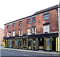
The New Clarence
The old Clarence originally stood on the opposite side of Charles Street to the current pub, a site now occupied by flats, and is depicted on the Inn sign. The New Clarence is a conversion of the old Co-op building on the corner of Charles and John Streets.
Image: © David Wright Taken: 24 Sep 2006
0.03 miles
  • ...