
IMAGES TAKEN NEAR TO
Ariconium Place, ROSS-ON-WYE, HR9 7HF
Introduction
This page details the photographs taken nearby to Ariconium Place, HR9 7HF by members of the Geograph project.
The Geograph project started in 2005 with the aim of publishing, organising and preserving representative images for every square kilometre of Great Britain, Ireland and the Isle of Man.

There are currently over 7.5m images from over14,400 individuals and you can help contribute to the project by visiting https://www.geograph.org.uk
Image Map
Images are licensed for reuse under creativecommons.org/licenses/by-sa/2.0
Notes
- Clicking on the map will re-center to the selected point.
- The higher the marker number, the further away the image location is from the centre of the postcode.
Image Listing (119 Images Found)
Images are licensed for reuse under creativecommons.org/licenses/by-sa/2.0
Image
Details
Distance
1
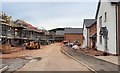
Ariconium Place, 3
A new housing development on the east side of Weston under Penyard.
Here is the section under construction as at July 2019.
Image: © Jonathan Billinger
Taken: 26 Jul 2019
0.01 miles
2

Sunset over Weston
The glow silhouettes village housing and St. Lawrence's church tower.
The edge of Penyard Hill is prominent to the left.
Image: © Jonathan Billinger
Taken: 22 Mar 2024
0.02 miles
3
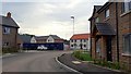
Ariconium Place, 2
A new housing development on the east side of Weston under Penyard.
Marketing suite to the left, some units now occupied.
Image: © Jonathan Billinger
Taken: 23 Jul 2019
0.02 miles
4

Ariconium Place, 4
A new housing development on the east side of Weston under Penyard.
The units closest to the A40 to the right are now occupied, the rest is still under construction.
Penyard Hill beyond to the left.
The tower of St. Lawrence's church can be seen above the new rooftops.
Image: © Jonathan Billinger
Taken: 29 Jul 2019
0.03 miles
5
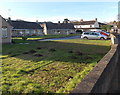
Molehills and bungalows in Weston-under-Penyard
Part of Penyard Gardens in the SE of the village.
Image: © Jaggery
Taken: 8 Dec 2013
0.05 miles
6
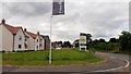
Ariconium Place, 1
Posh name for a new housing development on the east side of Weston under Penyard.
Here the frontage on the A40, looking towards the village, is complete with several houses now occupied whilst the area further away from the road is still a building site.
Image: © Jonathan Billinger
Taken: 22 Jul 2019
0.06 miles
7
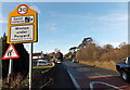
SE boundary of Weston-under-Penyard
The National Speed Limit along the A40 reduces to 30mph at the edge of
Weston-under-Penyard, a small village in Herefordshire near Ross-on-Wye.
The Penyard is a prominent nearby hill.
Image: © Jaggery
Taken: 8 Dec 2013
0.06 miles
8
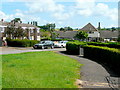
Seabrook Place, Weston under Penyard
Housing on the south-east side of the village.
The flats at the end are Penyard Gardens.
Image: © Jonathan Billinger
Taken: 14 Jun 2009
0.07 miles
9
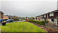
Village housing, Weston under Penyard
At the end of School Lane.
Image: © Jonathan Billinger
Taken: 11 May 2021
0.07 miles
10

Hole in the sky
After a day of spectacular showers and rainbows, the sunset colours illuminate a gap in the clouds over Weston under Penyard.
Image: © Jonathan Billinger
Taken: 29 Mar 2024
0.07 miles