
IMAGES TAKEN NEAR TO
Greytree Road, ROSS-ON-WYE, HR9 7DQ
Introduction
This page details the photographs taken nearby to Greytree Road, HR9 7DQ by members of the Geograph project.
The Geograph project started in 2005 with the aim of publishing, organising and preserving representative images for every square kilometre of Great Britain, Ireland and the Isle of Man.

There are currently over 7.5m images from over14,400 individuals and you can help contribute to the project by visiting https://www.geograph.org.uk
Image Map
Images are licensed for reuse under creativecommons.org/licenses/by-sa/2.0
Notes
- Clicking on the map will re-center to the selected point.
- The higher the marker number, the further away the image location is from the centre of the postcode.
Image Listing (1450 Images Found)
Images are licensed for reuse under creativecommons.org/licenses/by-sa/2.0
Image
Details
Distance
1
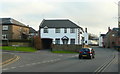
Greytree Road, Ross-on-Wye
Looking towards Fiveways at the junction of Nursery Road to the left.
Image: © Jonathan Billinger
Taken: 26 Dec 2008
0.01 miles
2
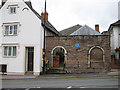
The Friends' Meeting House
The meeting house was built by James Merrick in 1675 and was enlarged and altered in 1803. A Quaker burial ground is attached to the site.
Image: © Pauline E
Taken: 5 Aug 2008
0.02 miles
3
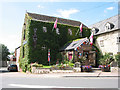
From old mill to furniture shop
Now Rudhall Brook Furnishings, sited by Rudhall Brook.
As early as 1086, a mill stood on this site. The mill buildings are of various dates from the early 18th century onwards.
Image: © Pauline E
Taken: 2 Aug 2007
0.02 miles
4
![Ross-on-Wye buildings [31]](https://s3.geograph.org.uk/geophotos/07/35/43/7354355_b45f39e0_120x120.jpg)
Ross-on-Wye buildings [31]
This Quaker Meeting House, 3A Brampton Street, was built in 1804 on the site of an earlier 17th century meeting house. Additions were made in then 20th century. Constructed in a 'L' plan of red sandstone under a hipped slate roof with some concrete tiles. Listed, grade II, with details at: https://historicengland.org.uk/listing/the-list/list-entry/1098727
Ross-on-Wye is an attractive market town in Herefordshire, near the border with Wales and within the Wye Valley Area of Outstanding Natural Beauty. Located on the east bank of the River Wye, the town is some 11¼ miles southeast of Hereford and 14¾ miles northwest of Gloucester. Settlement of the area dates back to the Iron Age. Today the town promotes itself as ‘the birthplace of British tourism’ and visitors are an important part of the economy.
Image: © Michael Dibb
Taken: 1 Sep 2022
0.03 miles
6
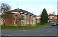
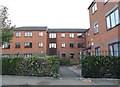
Flats on Nursery Road, Ross-on-Wye
Looking north from Greytree Road.
Image: © Jonathan Billinger
Taken: 26 Dec 2008
0.03 miles
7
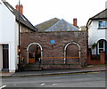
The Friends' Meeting House, Ross-on-Wye
A blue plaque http://www.geograph.org.uk/photo/3469661 on the wall shows that the Religious Society of Friends (Quakers) Meeting House
at 3A Brampton Street dates from 1668. There is a burial ground at the back of the Meeting House.
Image: © Jaggery
Taken: 30 Oct 2011
0.03 miles
8
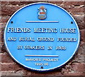
Blue plaque on the Friends Meeting House Ross-on-Wye
The plaque is on the wall here. http://www.geograph.org.uk/photo/3469656
Image: © Jaggery
Taken: 30 Oct 2011
0.03 miles
9
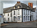
Grade II listed Brook House, Ross-on-Wye
On the corner of Greytree Road and Brampton Street. The earliest part of the house dates from the 17th century. Grade II listed in October 1952. Brook House is now divided into flats.
Image: © Jaggery
Taken: 30 Oct 2011
0.03 miles
10

Fonteine Court, Greytree Road, Ross-on-Wye
A retirement flat complex.
Image: © Jonathan Billinger
Taken: 26 Dec 2008
0.03 miles