
IMAGES TAKEN NEAR TO
Chapel Field, ROSS-ON-WYE, HR9 6HH
Introduction
This page details the photographs taken nearby to Chapel Field, HR9 6HH by members of the Geograph project.
The Geograph project started in 2005 with the aim of publishing, organising and preserving representative images for every square kilometre of Great Britain, Ireland and the Isle of Man.

There are currently over 7.5m images from over14,400 individuals and you can help contribute to the project by visiting https://www.geograph.org.uk
Image Map
Images are licensed for reuse under creativecommons.org/licenses/by-sa/2.0
Notes
- Clicking on the map will re-center to the selected point.
- The higher the marker number, the further away the image location is from the centre of the postcode.
Image Listing (97 Images Found)
Images are licensed for reuse under creativecommons.org/licenses/by-sa/2.0
Image
Details
Distance
1
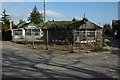
Redevelopment site in Llangrove
The site of a former garage and cottage in the centre of Llangrove await the bulldozer.
Image: © Philip Halling
Taken: 14 Mar 2009
0.03 miles
2
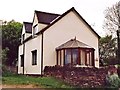
Former Methodist Chapel at Llangrove
Now a private home.
Image: © paul wood
Taken: 9 May 2004
0.05 miles
3
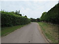
Byway in Llangrove, Herefordshire
Pointing ahead, a sign near the camera shows BYWAY. https://www.geograph.org.uk/photo/6228071
Image: © Jaggery
Taken: 4 Aug 2019
0.06 miles
4
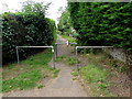
Metal barriers across a path, Llangrove, Herefordshire
Preventing vehicular misuse of the footpath on the south side of the main road through the village.
Image: © Jaggery
Taken: 4 Aug 2019
0.09 miles
5
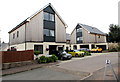
Chapel Close houses, Llangrove, Herefordshire
Houses built in the second decade of the 21st century viewed in August 2019.
Image: © Jaggery
Taken: 4 Aug 2019
0.09 miles
6
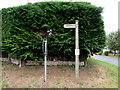
Byway direction sign, Llangrove, Herefordshire
The sign showing BYWAY points along this https://www.geograph.org.uk/photo/6228067 hedge-lined road.
Image: © Jaggery
Taken: 4 Aug 2019
0.09 miles
7
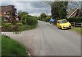
Junction in Llangrove, Herefordshire
Near the lychgate entrance https://www.geograph.org.uk/photo/6168577 to Christ Church.
Image: © Jaggery
Taken: 6 May 2019
0.10 miles
8
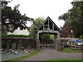
Churchyard side of a lychgate, Llangrove, Herefordshire
Derived from an old English word for a corpse, a lychgate is the roofed gateway to a burial ground,
formerly used to shelter a coffin until the clergyman’s arrival for the burial or pre-burial service.
This lychgate at the edge of Christ Church churchyard was erected in 1928. https://www.geograph.org.uk/photo/757966
Image: © Jaggery
Taken: 6 May 2019
0.11 miles
9
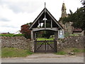
Lychgate at the entrance to Christ Church, Llangrove, Herefordshire
Derived from an old English word for a corpse, a lychgate is the roofed gateway to a burial ground,
formerly used to shelter a coffin until the clergyman’s arrival for the burial or pre-burial service.
This lychgate was erected in 1928. https://www.geograph.org.uk/photo/757966
Image: © Jaggery
Taken: 6 May 2019
0.11 miles
10
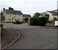
Chapel Meadows, Llangrove, Herefordshire
Cul-de-sac on the southwest side of the main road through the village.
The Royal Arms pub https://www.geograph.org.uk/photo/6227997 is on the right.
Image: © Jaggery
Taken: 4 Aug 2019
0.11 miles