
IMAGES TAKEN NEAR TO
Newlands Road, LEOMINSTER, HR6 8HL
Introduction
This page details the photographs taken nearby to Newlands Road, HR6 8HL by members of the Geograph project.
The Geograph project started in 2005 with the aim of publishing, organising and preserving representative images for every square kilometre of Great Britain, Ireland and the Isle of Man.

There are currently over 7.5m images from over14,400 individuals and you can help contribute to the project by visiting https://www.geograph.org.uk
Image Map
Images are licensed for reuse under creativecommons.org/licenses/by-sa/2.0
Notes
- Clicking on the map will re-center to the selected point.
- The higher the marker number, the further away the image location is from the centre of the postcode.
Image Listing (23 Images Found)
Images are licensed for reuse under creativecommons.org/licenses/by-sa/2.0
Image
Details
Distance
2
A44 becomes Bargates
To the west of here the 'A' road is named Baron's Cross Road.
Image: © Stuart Logan
Taken: 21 Sep 2013
0.13 miles
4
Ginhall Lane junction
Bargates becomes Barons Cross Road beyond the junction.
Image: © Peter Whatley
Taken: 25 Oct 2011
0.14 miles
5
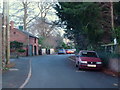
Ginhall Lane - approaching Bargates junction
Late afternoon in December.
Image: © Jonathan Billinger
Taken: 8 Dec 2017
0.16 miles
7
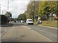
Pelican crossing on Barons Cross Road
Ropewalk Avenue forms the junction on the left.
Image: © Peter Whatley
Taken: 25 Oct 2011
0.18 miles
8
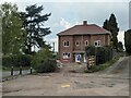
New housing development (Leominster)
Built on the site of a garage, this ginormous town house is now completed as of the upload of this picture. This is placed on the corner of Ginhall Lane, Green Lane and Pierrepont Road. This is an interesting structure in my opinion, and the trees by it are nice.
Image: © Fabian Musto
Taken: 1 May 2021
0.19 miles
10
Ginhall Lane
The junction with Green Lane has not been blocked off but the right turn is forbidden, presumably to stop dodging the traffic lights on the Cursneh Road/Bargates junction. Bikes are allowed though - note the gap.
Image: © Richard Webb
Taken: 4 Apr 2015
0.20 miles