
IMAGES TAKEN NEAR TO
Fawley, HEREFORD, HR1 4SW
Introduction
This page details the photographs taken nearby to HR1 4SW by members of the Geograph project.
The Geograph project started in 2005 with the aim of publishing, organising and preserving representative images for every square kilometre of Great Britain, Ireland and the Isle of Man.

There are currently over 7.5m images from over14,400 individuals and you can help contribute to the project by visiting https://www.geograph.org.uk
Image Map
Images are licensed for reuse under creativecommons.org/licenses/by-sa/2.0
Notes
- Clicking on the map will re-center to the selected point.
- The higher the marker number, the further away the image location is from the centre of the postcode.
Image Listing (17 Images Found)
Images are licensed for reuse under creativecommons.org/licenses/by-sa/2.0
Image
Details
Distance

2

Farmland at Warlocks
Carey Wood, in the background, covers the steep slope down to the River Wye.
Image: © David Purchase
Taken: 20 Oct 2013
0.11 miles
3

Unharvested wheat crop
Looking towards the church spire at Ballingham. In the distance, on the right is Capler Wood.
Image: © Pauline E
Taken: 21 Sep 2008
0.21 miles

5

Cottage in Aramstone Wood
Across the River Wye and seen through two of the piers of the dismantled Ballingham Bridge sits a cottage which must see very little of the sun in winter given its location.
Image: © Pauline E
Taken: 21 Sep 2008
0.22 miles
6

Cows by Ballingham viaduct
These cows were grazing in a field north-east from the disused railway viaduct. The viaduct carried the Hereford, Ross and Gloucester Railway from 1855 to 1964, and the viaduct spans the River Wye.
Image: © Fabian Musto
Taken: 25 Aug 2022
0.22 miles
7
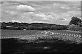
Sweetcorn crop
A field of young sweetcorn plants near Ballingham. The spire of Ballingham church is just visible in the left background. Taken from right on the grid line in black & white with a digitally simulated red filter on the lens.
Image: © John Winder
Taken: 15 Jun 2020
0.23 miles
8

Grassland at Ballingham Court
Looking north-east towards Ballingham Court. The spire of Ballingham Church just in view on the right.
Image: © Trevor Rickard
Taken: 31 Jan 2011
0.23 miles
9
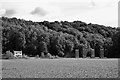
Ballingham viaduct and Glen Cottage
A black and white shot from a footpath in the middle of a field of young sweetcorn plants. The terrain which dictated the engineering of the railway line is well illustrated here: in the background is one of three interlocking spurs of high ground which the railway had to burrow through, in two cases via long tunnels and in one via a very deep cutting. Here, the train emerged from the gloom of Fawley tunnel straight onto Ballingham viaduct, and the sudden sunlight and spectacular view must have been a bit of a shock on a fine day!
Image: © John Winder
Taken: 15 Jun 2020
0.24 miles
10

Disused railway viaduct piers near Fawley tunnel
Image: © Anonymous
Taken: 28 Sep 2005
0.24 miles