IMAGES TAKEN NEAR TO
Bullrush Close, HEREFORD, HR1 2SU
Introduction
This page details the photographs taken nearby to Bullrush Close, HR1 2SU by members of the Geograph project.
The Geograph project started in 2005 with the aim of publishing, organising and preserving representative images for every square kilometre of Great Britain, Ireland and the Isle of Man.

There are currently over 7.5m images from over14,400 individuals and you can help contribute to the project by visiting https://www.geograph.org.uk
Image Map
Images are licensed for reuse under creativecommons.org/licenses/by-sa/2.0
Notes
- Clicking on the map will re-center to the selected point.
- The higher the marker number, the further away the image location is from the centre of the postcode.
Image Listing (61 Images Found)
Images are licensed for reuse under creativecommons.org/licenses/by-sa/2.0
Image
Details
Distance
1

Boundary Stone, Hereford
On the South side of Ledbury Road, near the rail bridge. Possibly denoting the boundary of the parish of St. Pauls, Tupsley and St. Peter with St. Owen and St. James (church at the end of St. Owen Street). Which might explain the inscriptions.
A collection of similar images can be seen at https://www.geograph.org.uk/article/Boundary-Stones-of-the-City-of-Hereford
Inscription: O P
Milestone Society National ID: HF_HERE04pb
Image: © Jayne Tovey
Taken: 6 Jan 2023
0.04 miles
2
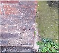
Ordnance Survey Cut Mark
This OS cut mark can be found on the gatepost of No16 Foley Street. It marks a point 52.532m above mean sea level.
Image: © Adrian Dust
Taken: 10 Mar 2019
0.05 miles
3
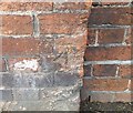
Ordnance Survey Cut Mark
This OS cut mark can be found on the north side of the railway bridge on Ledbury Road. It marks a point 51.051m above mean sea level.
Image: © Adrian Dust
Taken: 10 Mar 2019
0.09 miles
5
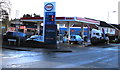
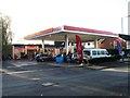
Extremely low fuel prices on display at an Esso garage in Hereford
On the corner of the A38 Ledbury Road and Lichfield Avenue, viewed in early January 2015, when fuel prices are falling. Missing digits on faulty displays show 8 per litre for unleaded petrol and 5 per litre for diesel. No unit of currency is shown, so if a driver suggests the charge should be 5 pence per litre,
the garage could retort by saying that it's £5 per litre...
Image: © Jaggery
Taken: 8 Jan 2015
0.12 miles
6
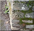
Ordnance Survey Cut Mark
This OS cut mark can be found at the junction of Central Avenue & Ledbury Road. It marks a point 52.1025m above mean sea level.
Image: © Adrian Dust
Taken: 10 Mar 2019
0.12 miles
7
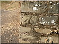
Benchmark, Central Avenue
A rather worn mark on the retaining wall of an earth mound, its visibility enhanced by moss. 52.10m above OSDN.
Image: © Keith Edkins
Taken: 14 Jul 2013
0.12 miles
8
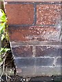
Ordnance Survey Cut Mark
This OS cut mark can be found on the wall of No16 Portfield Street. It marks a point 54.151m above mean sea level.
Image: © Adrian Dust
Taken: 10 Mar 2019
0.12 miles