
IMAGES TAKEN NEAR TO
Burrows Court, HEREFORD, HR1 2SN
Introduction
This page details the photographs taken nearby to Burrows Court, HR1 2SN by members of the Geograph project.
The Geograph project started in 2005 with the aim of publishing, organising and preserving representative images for every square kilometre of Great Britain, Ireland and the Isle of Man.

There are currently over 7.5m images from over14,400 individuals and you can help contribute to the project by visiting https://www.geograph.org.uk
Image Map
Images are licensed for reuse under creativecommons.org/licenses/by-sa/2.0
Notes
- Clicking on the map will re-center to the selected point.
- The higher the marker number, the further away the image location is from the centre of the postcode.
Image Listing (76 Images Found)
Images are licensed for reuse under creativecommons.org/licenses/by-sa/2.0
Image
Details
Distance
1
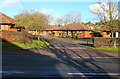
Burrows Court, Hereford
Bungalows on the north side of the B4224 Eign Road.
Image: © Jaggery
Taken: 8 Jan 2015
0.01 miles
3
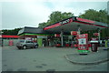
Texaco (Tupsley)
One out of two Texaco garages at Tupsley. The second one is only close-by to this one, which is quite strange!
Image: © Fabian Musto
Taken: 23 May 2018
0.02 miles
4
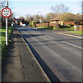
Headroom sign alongside Eign Road, Hereford
The sign gives advance warning of the 4.4 metres (14' 6") clearance
under the railway bridge http://www.geograph.org.uk/photo/4305294 100 metres ahead.
Image: © Jaggery
Taken: 8 Jan 2015
0.03 miles
5
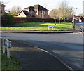
Quay Close junction in Hereford
The left turn is into Quay Close, a small cul-de-sac http://www.geograph.org.uk/photo/4305280 on the north bank of the River Wye.
A railway bridge over the B4224 Eign Road is in the background on the right.
Image: © Jaggery
Taken: 8 Jan 2015
0.04 miles
6
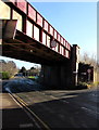
West side of a railway bridge over Eign Road, Hereford
About 1,300 metres SE of Hereford railway station, this railway bridge crosses
diagonally over the B4224 Eign Road. A red-edged circular sign on the bridge
shows 4.4 metres (14' 6") headroom (overhead clearance).
The 20mph speed limit sign on the right is on the corner of Outfall Works Road.
The back of a rectangular mirror is near the upper left corner of the photo.
Image: © Jaggery
Taken: 8 Jan 2015
0.05 miles
7
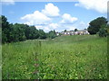
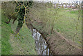
Wasteland by the Eign Brook
From Hampton Park Road looking north along the small stream valley. The stream is in the trees to the left and the houses of Sedgefield Road are to the right. This area is flood plain and is not built upon.
Image: © Trevor Rickard
Taken: 7 Jun 2008
0.05 miles
8
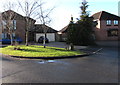
Quay Close, Hereford
Small cul-de-sac on the north bank of the River Wye, viewed from the edge of the B4224 Eign Road.
Image: © Jaggery
Taken: 8 Jan 2015
0.06 miles
9
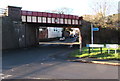
East side of a railway bridge over Eign Road, Hereford
About 1,300 metres SE of Hereford railway station, a railway bridge crosses diagonally over the B4224 Eign Road. A red-edged circular sign on the bridge shows 4.4 metres (14' 6") headroom (overhead clearance). Viewed from Eign Mill Road, where a sign points right towards Foley Trading Estate.
Image: © Jaggery
Taken: 8 Jan 2015
0.06 miles
10
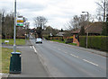
Railway crosses the B4224
The bridge carries the Hereford to Abergavenny line.
Image: © Pauline E
Taken: 25 Mar 2008
0.06 miles