IMAGES TAKEN NEAR TO
Latimer, CHESHAM, HP5 1UL
Introduction
This page details the photographs taken nearby to HP5 1UL by members of the Geograph project.
The Geograph project started in 2005 with the aim of publishing, organising and preserving representative images for every square kilometre of Great Britain, Ireland and the Isle of Man.

There are currently over 7.5m images from over14,400 individuals and you can help contribute to the project by visiting https://www.geograph.org.uk
Image Map
Images are licensed for reuse under creativecommons.org/licenses/by-sa/2.0
Notes
- Clicking on the map will re-center to the selected point.
- The higher the marker number, the further away the image location is from the centre of the postcode.
Image Listing (9 Images Found)
Images are licensed for reuse under creativecommons.org/licenses/by-sa/2.0
Image
Details
Distance
1
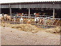
Cattle in barn, near Amersham
These are at White End Park Farm, taken from the footpath which goes to Chesham.
Image: © David Hawgood
Taken: 31 Jan 2006
0.01 miles
2
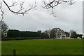
White End Park Farm
Some extensive building work going on on one of the farm buildings.
Image: © Graham Horn
Taken: 5 Feb 2011
0.10 miles
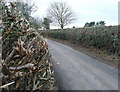
3
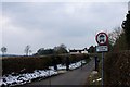
Closed road to White End Park Farm
The loop of road leading from Blackwell Hall Lane to White End Park Farm has recently been gated and closed to through traffic.
Image: © Simon Mortimer
Taken: 27 Mar 2013
0.10 miles
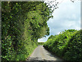
4
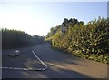
Green Lane at the junction of Blackwell Hall Lane
This leads to White End farm and was closed some time after 2008. The grass triangle was also replaced by the flat one here.
Image: © David Howard
Taken: 10 Sep 2015
0.12 miles
6
Lane to White End Park Farm
The hedges have been recently cut. This is clearly the work of a mechanical strimmer; the hedges are evenly shaped and the close-up on the left shows many raw ends of branches.
Image: © Graham Horn
Taken: 5 Feb 2011
0.19 miles
7
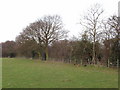
White End Park, near Botley
This is the edge of parkland. The land beyond the wood is shown on the map as a clay pit and brick works, and there was active extraction from the pit. There is a footpath along the edge of the field. View looking north-west.
Image: © David Hawgood
Taken: 31 Jan 2006
0.19 miles
8
Path heading towards Codmore Wood
Off Blackwell Hall Lane the path heading towards Codmore Wood
Image: © Shaun Ferguson
Taken: 4 Sep 2020
0.22 miles
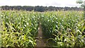
9
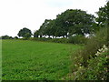
Field corner near Pinner Green
Looking south-west from Codmore Wood Road.
Image: © Jonathan Billinger
Taken: 1 Oct 2008
0.25 miles