IMAGES TAKEN NEAR TO
Tweed Close, BERKHAMSTED, HP4 1SY
Introduction
This page details the photographs taken nearby to Tweed Close, HP4 1SY by members of the Geograph project.
The Geograph project started in 2005 with the aim of publishing, organising and preserving representative images for every square kilometre of Great Britain, Ireland and the Isle of Man.

There are currently over 7.5m images from over14,400 individuals and you can help contribute to the project by visiting https://www.geograph.org.uk
Image Map
Images are licensed for reuse under creativecommons.org/licenses/by-sa/2.0
Notes
- Clicking on the map will re-center to the selected point.
- The higher the marker number, the further away the image location is from the centre of the postcode.
Image Listing (142 Images Found)
Images are licensed for reuse under creativecommons.org/licenses/by-sa/2.0
Image
Details
Distance
1
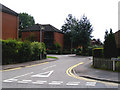
Brook Lane, Berkhamsted
Brook Lane as seen from its junction with Stag Lane. The name 'Brook' refers to the River Bulbourne, which must be culverted underground at this point, and so hidden from view.
Image: © David Sands
Taken: 8 Aug 2009
0.01 miles
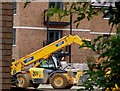
2
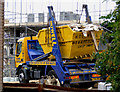
The Locks development at Stag Lane, Berkhamsted
Builder's waste taken away for disposal and recycling
Image: © David Sands
Taken: 8 Aug 2009
0.05 miles
3
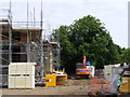
The Locks development at Stag Lane, Berkhamsted
The building site quietens down at the weekend
Image: © David Sands
Taken: 8 Aug 2009
0.05 miles
4
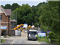
Stag Lane, Berkhamsted
Construction proceeds apace as the Stag Lane area is converted into a new housing estate christened "The Locks" because of its proximity to the Grand Union Canal.
Image: © David Sands
Taken: 8 Aug 2009
0.05 miles
5
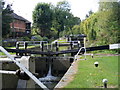
The Grand Union between Berkhamsted and Northchurch
The flight of two locks between Berkhamsted and Northchurch.
Image: © David Sands
Taken: 14 Sep 2007
0.05 miles
6
The Sacred Heart Catholic Church, Park St, Berkhamsted
Image: © David Sands
Taken: 14 Sep 2007
0.05 miles
7
The Locks development at Stag Lane, Berkhamsted
Building work as spied from the canal towpath
Image: © David Sands
Taken: 8 Aug 2009
0.05 miles
8
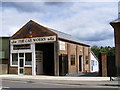
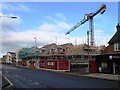
Berkhamsted High Street
Summer 2009 brings a new lease of life to the former Barford's Garage in Berkhamsted High Street. (Compare the photo taken by Ian Rob on 19 May 2009 http://www.geograph.org.uk/photo/1310961 .)
Image: © David Sands
Taken: 9 Jul 2009
0.05 miles
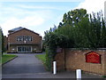
9
Churchill Retirement Living, under construction
Image: © Alex McGregor
Taken: 4 Feb 2015
0.05 miles
10
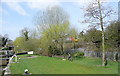
Northchurch lock 52
The bottom of four Northchurch locks. 51 is within sight. The parkland area is popular for dog walking and Pendolino spotting.
Image: © Graham Horn
Taken: 10 Apr 2010
0.06 miles