IMAGES TAKEN NEAR TO
Chinnor Road, PRINCES RISBOROUGH, HP27 9PH

Introduction

This page details the photographs taken nearby to Chinnor Road, HP27 9PH by members of the Geograph project.

The Geograph project started in 2005 with the aim of publishing, organising and preserving representative images for every square kilometre of Great Britain, Ireland and the Isle of Man.

There are currently over 7.5m images from over14,400 individuals and you can help contribute to the project by visiting https://www.geograph.org.uk

Image Map


Images are licensed for reuse under creativecommons.org/licenses/by-sa/2.0
Notes
  • Clicking on the map will re-center to the selected point.
  • The higher the marker number, the further away the image location is from the centre of the postcode.

Image Listing (7 Images Found)

Images are licensed for reuse under creativecommons.org/licenses/by-sa/2.0
Image
Details
Distance
1
Risborough Service Centre, Bledlow
Image: © David Howard Taken: 10 Aug 2017
0.02 miles
2
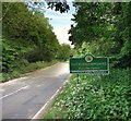
B4009 at Bledlow village boundary
Image: © Colin Pyle Taken: 27 Feb 2016
0.02 miles
3
House on Chinnor Road, Bledlow
Image: © David Howard Taken: 10 Aug 2017
0.03 miles
4
Coming into Bledlow
This is the Lower Icknield Way, the B4009. Not much of Bledlow is actually beside it. The main part of the village is off to the south.
Image: © Des Blenkinsopp Taken: 19 May 2014
0.03 miles
5
B4009 at Buckinghamshire county boundary
Image: © Colin Pyle Taken: 27 Feb 2016
0.19 miles
6
The Buckinghamshire Border
A small stream running under the road here separates Oxfordshire and Buckinghamshire. The bit about Paralympics has been added to the Bucks county sign. It refers to the 1948 Stoke Mandeville games held near Aylesbury, which was the first organized contest for athletes with disabilities. The event is recognized as the origin of today's Paralympic Games. http://www.bbc.co.uk/news/uk-14896776
Image: © Des Blenkinsopp Taken: 19 May 2014
0.20 miles
7
Houses in Bledlow
Image: © David Hawgood Taken: 4 Aug 2005
0.23 miles