IMAGES TAKEN NEAR TO
Springhall Hill, TRING, HP23 6NL
Introduction
This page details the photographs taken nearby to Springhall Hill, HP23 6NL by members of the Geograph project.
The Geograph project started in 2005 with the aim of publishing, organising and preserving representative images for every square kilometre of Great Britain, Ireland and the Isle of Man.

There are currently over 7.5m images from over14,400 individuals and you can help contribute to the project by visiting https://www.geograph.org.uk
Image Map
Images are licensed for reuse under creativecommons.org/licenses/by-sa/2.0
Notes
- Clicking on the map will re-center to the selected point.
- The higher the marker number, the further away the image location is from the centre of the postcode.
Image Listing (27 Images Found)
Images are licensed for reuse under creativecommons.org/licenses/by-sa/2.0
Image
Details
Distance
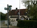
2
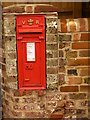
Victorian Post Box, Buckland Common
At the junction of Bottom Road, Little Twye Road and Parrots Lane. Taken just after the post box and its surrounding brickwork had been carefully renovated (2007-8).
Image: © Linda Wordsworth
Taken: 27 Feb 2008
0.04 miles
5
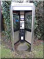
Former KX300 Telephone Kiosk at Buckland Common
Situated in Parrott's Lane HP23 6NX, this telephone kiosk has a BT notice above the payphone mentioning that it will soon be removed due to lack of usage. The former BT Piper logo can be seen on the glass panel each side of the kiosk. Update: the telephone kiosk has since been removed from this location.
Image: © David Hillas
Taken: 17 Feb 2017
0.06 miles
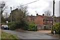
6
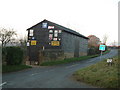
Barn with old signs, Buckland Common
There are a number of interesting old enamelled signs on this barn on Little Twye Road in Buckland Common. It is almost bisected by the 920 grid line.
Image: © Rob Farrow
Taken: 10 Dec 2005
0.08 miles
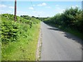
7

Farmland at Buckland Common
The Chiltern Way heads for the gate to cross Bottom Road, and then on to the White Lion pub (see Image).
Image: © David Purchase
Taken: 9 Apr 2015
0.08 miles
8
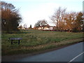
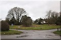
A Common off Parrott's Lane, Buckland Common
There are several green areas around Buckland Common - whether any particular one is the eponymous "Common" I don't know.
Image: © Rob Farrow
Taken: 10 Dec 2005
0.08 miles