IMAGES TAKEN NEAR TO
Bradenham Road, HIGH WYCOMBE, HP14 4ES

Introduction

This page details the photographs taken nearby to Bradenham Road, HP14 4ES by members of the Geograph project.

The Geograph project started in 2005 with the aim of publishing, organising and preserving representative images for every square kilometre of Great Britain, Ireland and the Isle of Man.

There are currently over 7.5m images from over14,400 individuals and you can help contribute to the project by visiting https://www.geograph.org.uk

Image Map


Images are licensed for reuse under creativecommons.org/licenses/by-sa/2.0
Notes
  • Clicking on the map will re-center to the selected point.
  • The higher the marker number, the further away the image location is from the centre of the postcode.

Image Listing (78 Images Found)

Images are licensed for reuse under creativecommons.org/licenses/by-sa/2.0
  • ...
Image
Details
Distance
1
Flint Hall Farm
House and barns are grade II listed buildings, 17th and 18th centuries.
Image: © Robin Webster Taken: 23 Nov 2017
0.02 miles
2
Bradenham valley
This broad, dry valley carries the A4010 towards Bradenham and Princes Risborough. The railway also follows the valley, to the right. A winter wheat crop lies dormant in the field.
Image: © Graham Horn Taken: 15 Jan 2012
0.04 miles
3
A4010 north of Flinthall Farm
Image: © Stuart Logan Taken: 30 Jul 2014
0.05 miles
4
Bradenham Road, West Wycombe
Image: © David Howard Taken: 11 Feb 2018
0.07 miles
5
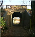
Footpath under the railway
This carries to Aylesbury to London Marylebone railway line, next stop to the right High Wycombe. The footpath heads towards Cookshall Farm.
Image: © Graham Horn Taken: 15 Jan 2012
0.09 miles
6
Carters Steam Fair
High Wycombe town centre on the misty horizon, reached by West Wycombe Road. Crane in the far distance is part of the Eden Shopping Centre construction project.
Image: © Ian Mulder Taken: 20 May 2007
0.10 miles
7
Sports field on Bradenham Road, West Wycombe
The car park was added some time after 2008 when it was just grass
Image: © David Howard Taken: 20 Mar 2016
0.11 miles
8
West Wycombe
Looking southeast along West Wycombe Road
Image: © Brendan and Ruth McCartney Taken: 21 Apr 2005
0.11 miles
9
Carter's Steam Fair - mobile home
This huge trailer towed by a tractor unit is obviously home to somebody important - probably the guv'nor himself - Joby Carter.
Image: © Chris Allen Taken: 24 Jul 2016
0.11 miles
10
Carter's steam Fair - Dodgems
Traditional fairground ride - bumping definitely allowed. I had to google how these work. I could see the electricity was being picked up from an electrified grid above by the pole on the car but I was mystified as to how the circuit was completed. The answer is that the floor is also metal and the other contact is under the car and completes the circuit. The floor is effectively at zero potential.
Image: © Chris Allen Taken: 24 Jul 2016
0.12 miles
  • ...