IMAGES TAKEN NEAR TO
Ashfield, HARROGATE, HG3 5HJ
Introduction
This page details the photographs taken nearby to Ashfield, HG3 5HJ by members of the Geograph project.
The Geograph project started in 2005 with the aim of publishing, organising and preserving representative images for every square kilometre of Great Britain, Ireland and the Isle of Man.

There are currently over 7.5m images from over14,400 individuals and you can help contribute to the project by visiting https://www.geograph.org.uk
Image Map
Images are licensed for reuse under creativecommons.org/licenses/by-sa/2.0
Notes
- Clicking on the map will re-center to the selected point.
- The higher the marker number, the further away the image location is from the centre of the postcode.
Image Listing (178 Images Found)
Images are licensed for reuse under creativecommons.org/licenses/by-sa/2.0
Image
Details
Distance
1
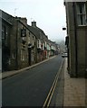
Pateley Bridge High Street
In Nidderdale
Image: © Paul Baxter
Taken: 1 Apr 2005
0.07 miles
3
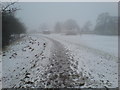
Pateley Bridge - Recreation Ground
The recreation ground alongside the Nidd at Pateley Bridge in February 2010
Image: © BC
Taken: 24 Feb 2010
0.11 miles
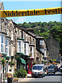
5
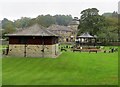
Bowling pavilion and Bandstand
Municipal park in Pateley Bridge.
Image: © philandju
Taken: 16 Sep 2014
0.12 miles
6
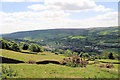
Caravans and mobile homes west of Pateley Bridge.
Even though they occupy a smaller area the mobile structures cause a bigger visual impact, from high on Wath Lane, than the town proper.
Image: © Stuart Logan
Taken: 28 May 2010
0.12 miles
7
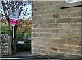
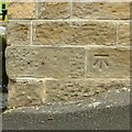
Pateley Bridge, old brewery
The benchmark is cut into the 2nd course of stone and at the extreme left of the building.
Image: © Mel Towler
Taken: 7 Nov 2021
0.12 miles
8
Pateley Bridge, old brewery
The benchmark is cut into the 2nd course of stone and at the extreme left of the building, and close to the For Sale sign.
Image: © Mel Towler
Taken: 7 Nov 2021
0.12 miles
9
Bench mark, Low Wath Road, Bridgehouse Gate, Pateley Bridge
See http://www.geograph.org.uk/photo/5536601 for location.
Image: © Alan Murray-Rust
Taken: 9 Sep 2017
0.12 miles
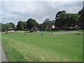
10
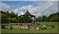
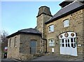
Bandstand, Recreation Ground, Pateley Bridge
Image: © habiloid
Taken: 8 Aug 2018
0.12 miles