IMAGES TAKEN NEAR TO
Denby Lane, HUDDERSFIELD, HD8 8XZ
Introduction
This page details the photographs taken nearby to Denby Lane, HD8 8XZ by members of the Geograph project.
The Geograph project started in 2005 with the aim of publishing, organising and preserving representative images for every square kilometre of Great Britain, Ireland and the Isle of Man.

There are currently over 7.5m images from over14,400 individuals and you can help contribute to the project by visiting https://www.geograph.org.uk
Image Map
Images are licensed for reuse under creativecommons.org/licenses/by-sa/2.0
Notes
- Clicking on the map will re-center to the selected point.
- The higher the marker number, the further away the image location is from the centre of the postcode.
Image Listing (9 Images Found)
Images are licensed for reuse under creativecommons.org/licenses/by-sa/2.0
Image
Details
Distance
1
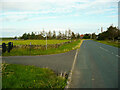
Footpath off Denby Lane, Upper Denby
This goes through a pedestrian gate and along the driveway to Moor Royd Nook. It leads to a network of paths on the hillside south of Denby Dale.
Image: © Humphrey Bolton
Taken: 28 Sep 2020
0.05 miles
2
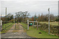
Moor Royd, near Upper Denby
With a green gate, green post-box and green signs . . . nestling among protective trees in its upland position.
Image: © Chris Yeates
Taken: 2 Jan 2006
0.06 miles
3
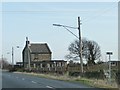
Much extended house, Denby Lane
But only on the ground floor.
Image: © Christine Johnstone
Taken: 6 Jan 2012
0.12 miles
4
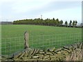
Line of conifers along a field boundary
North of Denby Lane.
Image: © Christine Johnstone
Taken: 6 Jan 2012
0.18 miles
5
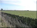
Large field at Denby Common
South of Denby Lane.
Image: © Christine Johnstone
Taken: 6 Jan 2012
0.19 miles
6
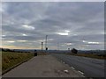
High Flatts lay-by
Near Ingbirchworth heading towards Penistone.
Image: © Steve Fareham
Taken: 3 Jan 2009
0.22 miles
8
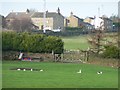
Duck pond in a field near High Flatts
North of Denby Lane.
Image: © Christine Johnstone
Taken: 6 Jan 2012
0.23 miles
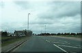
9
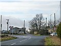
Green Lane End
Where Green Lane and Denby Lane meet the Penistone Road. Also the 293 metre spot height.
Image: © Christine Johnstone
Taken: 6 Jan 2012
0.24 miles