1
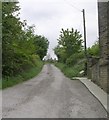
Lower Cote Cottage, Fixby
Presumably built in the 19C for a farm employee, it would be much better than the back-to-backs in the towns.
Image: © Humphrey Bolton
Taken: 23 Aug 2006
0.04 miles
2
Lower Cote Farmhouse, Fixby
Times must have been good for farmers when this substantial farmhouse was built in the 19C.
Image: © Humphrey Bolton
Taken: 23 Aug 2006
0.04 miles
3
Reservoir for trough,Clough Lane A6107, Rastrick
It pays to have a close look at 1:2500 maps. I noticed a small rectangle behind the trough at the end of the lane to Lower Cote, so climbed up to investigate. I found this reservoir or tank which presumably was made to ensure a steady supply of water to the trough shown in
Image When full it overflows into a little stream channel, see
Image
Image: © Humphrey Bolton
Taken: 18 Sep 2008
0.05 miles
4
Footpath - Clough Lane, Rastrick
Image: © Betty Longbottom
Taken: 14 May 2008
0.05 miles
5
Trough, Clough Lane, Rastrick
A large stone drinking trough for animals. The well-made entrance on the left is a mystery; it seems too narrow for the gateway of a house, but it gives access to the stream-bed above the trough.
Image: © Humphrey Bolton
Taken: 1 Sep 2006
0.05 miles
6
Stream bed behind trough, Clough Lane, Rastrick
The land has been eroded here, and a land drain sticks out from the hillside. In wet weather water flows through an opening in the wall into the road.
Image: © Humphrey Bolton
Taken: 1 Sep 2006
0.05 miles
7
Clough Lane A6107, Rastrick
This is in the part of Rastrick that is now in the Kirklees Council area, the boundary of which is along the M62. The motorway crosses Clough Lane in the distance. The Clough House Inn is on the right, and also the end of Toothill lane South. On the left there is a trough that has been overflowing onto the road.
Image: © Humphrey Bolton
Taken: 2 Mar 2006
0.05 miles
8
Footpath from Lower Cote to Upper Cote, Fixby (1)
The first section of this footpath is an old lane in a tunnel of trees.
Image: © Humphrey Bolton
Taken: 23 Aug 2006
0.10 miles
9
WCWW washout valve plate, Clough Lane
WCWW is Wakefield Corporation Water Works, and the main must be the long distance supply main between the storage reservoirs at Ringstone Edge and East Ardsley. I have also found a WWCW plate at Outlane, giving the diameter as 21 inches.
Image: © Humphrey Bolton
Taken: 4 Apr 2013
0.10 miles
10
Cottage below the road, Clough Lane, Rastrick
Here it is evident that the road has been raised and /or widened, and the old cottage is considerably below the present road level. Note that although this is now in the Kirklees Metropolitan Council area, it is within the old boundary of Rastrick.
Image: © Humphrey Bolton
Taken: 26 Feb 2007
0.10 miles


