1
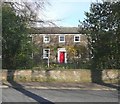
Bowling Alley Terrace - Bowling Alley
Image: © Betty Longbottom
Taken: 29 Jun 2009
0.01 miles
2
Scholey Avenue - looking towards Scholey Road
Image: © Betty Longbottom
Taken: 30 Jul 2013
0.03 miles
3
Ivy House, Rastrick Common, Rastrick
Ivy House was originally the home of the owner of the mill on the adjacent Rosemary Lane, and it was subsequently extended and used as an "old folks home". It has recently been extensively refurbished by the Cygnet group as one of their treatment facilities.
Rastrick Common is the road name - the common has long since been enclosed.
Image: © Humphrey Bolton
Taken: 8 Apr 2006
0.04 miles
4
Sunnydale Avenue, Rastrick
This estate was built some time between 1934 and 1948 on a field named Croft.
Image: © Humphrey Bolton
Taken: 8 Apr 2006
0.04 miles
5
The Poplars, Rastrick Common, Rastrick
The back of the house was built as a farmhouse in the early 18C, and the front was added c.1780 by Joseph Fryer, “yeoman and stuff maker”. He was a Quaker. Later Fryers were doctors, who practised in the house.
Image: © Humphrey Bolton
Taken: 24 Mar 2008
0.04 miles
6
Old field wall, Rastrick Common, Rastrick
When recording the suburbs, one tends to look up the cul-de-sacs as in this image of Sunnydale Avenue
Image, but the in-between boundaries can also be interesting, as here we have (presumably) the dry-stone wall between the fields Middle Scholey on the left and Croft on the right.
Image: © Humphrey Bolton
Taken: 1 Sep 2008
0.04 miles
7
Bowling Alley, Rastrick
Image: © yorkshirelad
Taken: 14 Nov 2021
0.04 miles
8
South Lodge, Rastrick Common, Rastrick
This house was built in 1879, but uses much material from a house of 1659 in Birds Royd, which was demolished for an extension to the railway sidings. Notable features are a row of carved rings along the side wall to the right of the photo, and the small stepped windows facing the road, to the right of the chimney. The road junction is the southern end of Rastrick Common. The old main road turns right up Ogden Lane, and Toothill Bank climbs up to the left. The pub is appropriately called 'The Junction'.
Image: © Humphrey Bolton
Taken: 17 Dec 2005
0.05 miles
9
Bowling Alley Terrace, Rastrick
A short street off Bowling Alley, presumably private beyond the gate posts.
Image: © Humphrey Bolton
Taken: 22 Jan 2007
0.05 miles
10
Lower end of Bowling Alley, Rastrick
Looking down towards Rastrick Common, with Bowling Alley Terrace to the left.
Image: © Humphrey Bolton
Taken: 22 Jan 2007
0.05 miles


