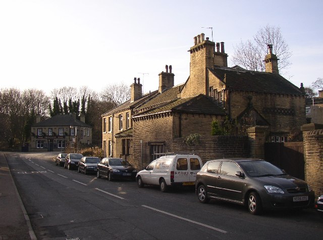
South Lodge, Rastrick Common, Rastrick
Introduction
The photograph on this page of South Lodge, Rastrick Common, Rastrick by Humphrey Bolton as part of the Geograph project.
The Geograph project started in 2005 with the aim of publishing, organising and preserving representative images for every square kilometre of Great Britain, Ireland and the Isle of Man.
There are currently over 7.5m images from over 14,400 individuals and you can help contribute to the project by visiting https://www.geograph.org.uk

Image: © Humphrey Bolton Taken: 17 Dec 2005
This house was built in 1879, but uses much material from a house of 1659 in Birds Royd, which was demolished for an extension to the railway sidings. Notable features are a row of carved rings along the side wall to the right of the photo, and the small stepped windows facing the road, to the right of the chimney. The road junction is the southern end of Rastrick Common. The old main road turns right up Ogden Lane, and Toothill Bank climbs up to the left. The pub is appropriately called 'The Junction'.
Image Location


