IMAGES TAKEN NEAR TO
Tolson Crescent, HUDDERSFIELD, HD5 9TU
Introduction
This page details the photographs taken nearby to Tolson Crescent, HD5 9TU by members of the Geograph project.
The Geograph project started in 2005 with the aim of publishing, organising and preserving representative images for every square kilometre of Great Britain, Ireland and the Isle of Man.

There are currently over 7.5m images from over14,400 individuals and you can help contribute to the project by visiting https://www.geograph.org.uk
Image Map
Images are licensed for reuse under creativecommons.org/licenses/by-sa/2.0
Notes
- Clicking on the map will re-center to the selected point.
- The higher the marker number, the further away the image location is from the centre of the postcode.
Image Listing (79 Images Found)
Images are licensed for reuse under creativecommons.org/licenses/by-sa/2.0
Image
Details
Distance
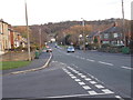
1
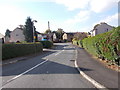
Tolson Crescent - Dalton Green Lane
Image: © Betty Longbottom
Taken: 26 Oct 2015
0.05 miles
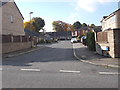
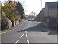
7
Electricity Substation No 526 - Dalton Green Lane
Image: © Betty Longbottom
Taken: 26 Oct 2015
0.08 miles
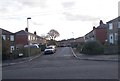
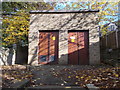
8
Mill Hill Community Health Centre - Dalton Green Lane
Image: © Betty Longbottom
Taken: 26 Oct 2015
0.09 miles
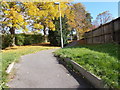
9
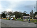
Bus shelter, Long Lane, Dalton
Near the junction with Dalton Green Lane.
Image: © Stephen Craven
Taken: 25 Jan 2020
0.09 miles
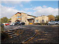
10
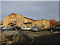
Mill Hill Community Health Centre
Image: © Jonathan Thacker
Taken: 14 Jan 2016
0.09 miles