IMAGES TAKEN NEAR TO
Hill Top Road, HUDDERSFIELD, HD5 9LX
Introduction
This page details the photographs taken nearby to Hill Top Road, HD5 9LX by members of the Geograph project.
The Geograph project started in 2005 with the aim of publishing, organising and preserving representative images for every square kilometre of Great Britain, Ireland and the Isle of Man.

There are currently over 7.5m images from over14,400 individuals and you can help contribute to the project by visiting https://www.geograph.org.uk
Image Map
Images are licensed for reuse under creativecommons.org/licenses/by-sa/2.0
Notes
- Clicking on the map will re-center to the selected point.
- The higher the marker number, the further away the image location is from the centre of the postcode.
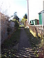
Image Listing (84 Images Found)
Images are licensed for reuse under creativecommons.org/licenses/by-sa/2.0
Image
Details
Distance
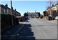
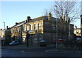
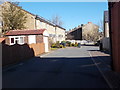
1
Mount Pleasant Street - Hill Top Road
Image: © Betty Longbottom
Taken: 7 Mar 2016
0.02 miles
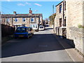
4
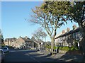
Broad Lane, Moldgreen
This is the junction where Long Lane goes to the right and Carr Green Lane to the left.
Image: © Humphrey Bolton
Taken: 19 Oct 2011
0.06 miles
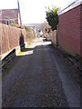
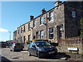
8
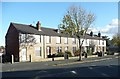
Terrace houses, Broad Lane, Moldgreen
Image: © Humphrey Bolton
Taken: 19 Oct 2011
0.07 miles