IMAGES TAKEN NEAR TO
Longfield Avenue, HUDDERSFIELD, HD5 9LF
Introduction
This page details the photographs taken nearby to Longfield Avenue, HD5 9LF by members of the Geograph project.
The Geograph project started in 2005 with the aim of publishing, organising and preserving representative images for every square kilometre of Great Britain, Ireland and the Isle of Man.

There are currently over 7.5m images from over14,400 individuals and you can help contribute to the project by visiting https://www.geograph.org.uk
Image Map
Images are licensed for reuse under creativecommons.org/licenses/by-sa/2.0
Notes
- Clicking on the map will re-center to the selected point.
- The higher the marker number, the further away the image location is from the centre of the postcode.
Image Listing (29 Images Found)
Images are licensed for reuse under creativecommons.org/licenses/by-sa/2.0
Image
Details
Distance
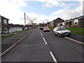
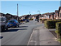
4
Carr Green Lane - viewed from Buttermere Drive
Image: © Betty Longbottom
Taken: 7 Mar 2016
0.15 miles
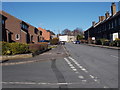
6
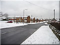
Flats along Ridgeway, Dalton
A bit of infill, built at right angles to the road.
Image: © Christine Johnstone
Taken: 20 Jan 2013
0.15 miles
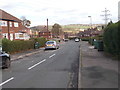
8
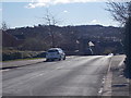
Carr Green Lane - viewed from Buttermere Drive
Image: © Betty Longbottom
Taken: 7 Mar 2016
0.17 miles
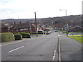
9
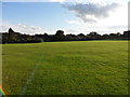
Playing fields, Dalton
Looking across playing fields off Ridgway.
Image: © Samantha Waddington
Taken: 25 Sep 2011
0.18 miles
10
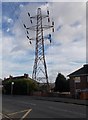
Electricity Pylon No PTD 34 - Rawthorpe Lane
Image: © Betty Longbottom
Taken: 16 Nov 2015
0.18 miles