IMAGES TAKEN NEAR TO
Mayfield Grove, HUDDERSFIELD, HD5 9HP
Introduction
This page details the photographs taken nearby to Mayfield Grove, HD5 9HP by members of the Geograph project.
The Geograph project started in 2005 with the aim of publishing, organising and preserving representative images for every square kilometre of Great Britain, Ireland and the Isle of Man.

There are currently over 7.5m images from over14,400 individuals and you can help contribute to the project by visiting https://www.geograph.org.uk
Image Map
Images are licensed for reuse under creativecommons.org/licenses/by-sa/2.0
Notes
- Clicking on the map will re-center to the selected point.
- The higher the marker number, the further away the image location is from the centre of the postcode.
Image Listing (51 Images Found)
Images are licensed for reuse under creativecommons.org/licenses/by-sa/2.0
Image
Details
Distance
2
Roebuck Memorial Homes - Wakefield Road
Image: © Betty Longbottom
Taken: 19 Jul 2008
0.07 miles
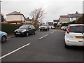
3
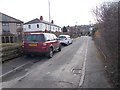
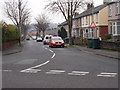
Rowlands Avenue - Dalton Green Lane
Image: © Betty Longbottom
Taken: 29 Feb 2016
0.08 miles
5
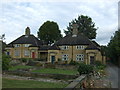
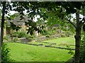
Roebuck Memorial Homes
Listed charity housing off Wakefield Road.
Image: © JThomas
Taken: 3 Oct 2014
0.09 miles
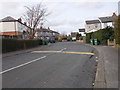
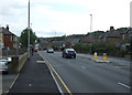
6
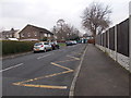
Green Lea Road - Dalton Green Lane
Image: © Betty Longbottom
Taken: 19 Jan 2016
0.09 miles
8
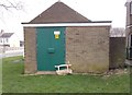
Electricity Substation No 1526 - Rowlands Avenue
Image: © Betty Longbottom
Taken: 29 Feb 2016
0.10 miles
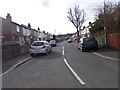
9
Brooklyn Avenue - Dalton Green Lane
Image: © Betty Longbottom
Taken: 19 Jan 2016
0.10 miles
10
Mayfield Avenue - Dalton Green Lane
Image: © Betty Longbottom
Taken: 19 Jan 2016
0.12 miles