IMAGES TAKEN NEAR TO
Sharp Lane, HUDDERSFIELD, HD5 8XL

Introduction

This page details the photographs taken nearby to Sharp Lane, HD5 8XL by members of the Geograph project.

The Geograph project started in 2005 with the aim of publishing, organising and preserving representative images for every square kilometre of Great Britain, Ireland and the Isle of Man.

There are currently over 7.5m images from over14,400 individuals and you can help contribute to the project by visiting https://www.geograph.org.uk

Image Map


Images are licensed for reuse under creativecommons.org/licenses/by-sa/2.0
Notes
  • Clicking on the map will re-center to the selected point.
  • The higher the marker number, the further away the image location is from the centre of the postcode.

Image Listing (78 Images Found)

Images are licensed for reuse under creativecommons.org/licenses/by-sa/2.0
  • ...
Image
Details
Distance
1
Footpath, Grasscroft, Almondbury.
Footpath leading from Grasscroft to Sharp Lane. Looking towards some beautiful autumn trees by the lane.
Image: © Samantha Waddington Taken: 18 Sep 2011
0.04 miles
2
The Radcliffe Arms, Westgate, Almondbury
In mock-Tudor style.
Image: © Humphrey Bolton Taken: 14 Sep 2007
0.05 miles
3
The Methodist Church, Westgate, Almondbury
This modern building seems to be the third on the site; the chapel was founded in 1842 (the elliptical plaque is preserved alongside the lane on the left side, and is shown here Image]). It was rebuilt in 1900 and most of that building is at the rear, facing Stocks Walk, see Image
Image: © Humphrey Bolton Taken: 19 Mar 2008
0.05 miles
4
Westgate, Almondbury
Looking south west.
Image: © JThomas Taken: 3 Oct 2014
0.07 miles
5
The Radcliffe Arms pub, Almondbury
Image: © JThomas Taken: 3 Oct 2014
0.07 miles
6
Almondbury Methodist Church
Image: © JThomas Taken: 3 Oct 2014
0.08 miles
7
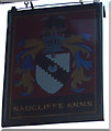
Sign for the Radcliffe Arms pub, Almondbury
Image: © JThomas Taken: 3 Oct 2014
0.09 miles
8
Almondbury Bowling Club - Cemetery Walk
Image: © Betty Longbottom Taken: 16 Sep 2008
0.10 miles
9
Westgate, Almondbury
There was a chapel on the north side of Westgate, and I think that the site is marked by the garden on the left.
Image: © Humphrey Bolton Taken: 14 Sep 2007
0.10 miles
10
The Woolpack, Westgate, Almondbury
Beyond it is Wormalls Hall, a 16C timber-framed house the ground floor of which was cased in stone in 1631.
Image: © Humphrey Bolton Taken: 14 Sep 2007
0.11 miles
  • ...