IMAGES TAKEN NEAR TO
Penistone Road, HUDDERSFIELD, HD5 8RN
Introduction
This page details the photographs taken nearby to Penistone Road, HD5 8RN by members of the Geograph project.
The Geograph project started in 2005 with the aim of publishing, organising and preserving representative images for every square kilometre of Great Britain, Ireland and the Isle of Man.

There are currently over 7.5m images from over14,400 individuals and you can help contribute to the project by visiting https://www.geograph.org.uk
Image Map
Images are licensed for reuse under creativecommons.org/licenses/by-sa/2.0
Notes
- Clicking on the map will re-center to the selected point.
- The higher the marker number, the further away the image location is from the centre of the postcode.
Image Listing (46 Images Found)
Images are licensed for reuse under creativecommons.org/licenses/by-sa/2.0
Image
Details
Distance
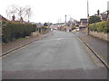
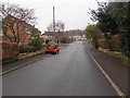
4

View towards Almondbury
From the top of a former railway cutting of the Kirkburton branch line
Image: © Kevin Waterhouse
Taken: 16 Jun 2024
0.10 miles
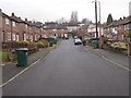
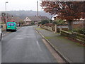
7
Mountfield Avenue - Mountfield Road
Image: © Betty Longbottom
Taken: 19 Jan 2016
0.12 miles
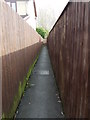
8
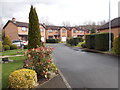
Beckside Gardens - Fenay Lea Drive
Image: © Betty Longbottom
Taken: 29 Mar 2016
0.12 miles
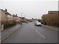
9
Mountfield Avenue - Southfield Road
Image: © Betty Longbottom
Taken: 4 Apr 2016
0.13 miles
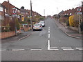
10
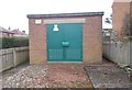
Electricity Substation No 55 - Southfield Road
Image: © Betty Longbottom
Taken: 4 Apr 2016
0.15 miles