IMAGES TAKEN NEAR TO
Helme Lane, HUDDERSFIELD, HD5 0BX

Introduction

This page details the photographs taken nearby to Helme Lane, HD5 0BX by members of the Geograph project.

The Geograph project started in 2005 with the aim of publishing, organising and preserving representative images for every square kilometre of Great Britain, Ireland and the Isle of Man.

There are currently over 7.5m images from over14,400 individuals and you can help contribute to the project by visiting https://www.geograph.org.uk

Image Map


Images are licensed for reuse under creativecommons.org/licenses/by-sa/2.0
Notes
  • Clicking on the map will re-center to the selected point.
  • The higher the marker number, the further away the image location is from the centre of the postcode.

Image Listing (58 Images Found)

Images are licensed for reuse under creativecommons.org/licenses/by-sa/2.0
  • ...
Image
Details
Distance
1
Houses by the railway off Helme Lane
Another contributor suggests these were built for railway workers Image; I would go further and suggest that as there was once a signal box on the other side of the main line controlling what was then a complex junction and goods yard, they would have been provided for the signalling staff specifically, who would no doubt have worked shifts when the railway was a 24-hour operation and one of the busiest freight routes in the country.
Image: © Stephen Craven Taken: 4 Jul 2022
0.00 miles
2
Cottages At Heaton Lodge Junction
An attractive row of four cottages. The cottages back onto the main railway line from Huddersfield to Leeds and were presumably originally built as railwaymen's cottages.
Image: © Tim Marchant Taken: 27 Aug 2008
0.00 miles
3
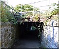
Pedestrian tunnel under Heaton Lodge Junction
There isn't a great deal of headroom in the small tunnel under the railway between Helm Lane and the River Calder upstream of Battyeford. One has to fight of dangling brambles, and although dry at this time, after a period of heavy rain, it is probably ankle deep in sludge.
Image: © Bobby Clegg Taken: 18 Sep 2015
0.02 miles
4
Houses off Helm Lane, Kirkheaton
An unexpected block of urban houses in a rural setting. They are next to the railway, and might have been built for railway workers.
Image: © Humphrey Bolton Taken: 18 Nov 2006
0.04 miles
5
Battyeford - railway footbridge
Image: © Dave Bevis Taken: 7 Nov 2009
0.05 miles
6
From Fall Ing 12 miles
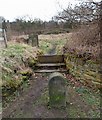
Marker stone adjacent to the canal.
Image: © Steve Fareham Taken: 25 Mar 2008
0.07 miles
7
Old Milemarker at Battyeford, Mirfield parish
Milemarker by the Calder & Hebble Navigation, in parish of Mirfield (Kirklees District), Battyeford. Inscription reads:- From FALL ING 12 Miles Surveyed Milestone Society National ID: CHN-12
Image: © Milestone Society Taken: Unknown
0.07 miles
8
Narrowboat moorings, Calder & Hebble Navigation, Battyeford
Image: © Michael Steele Taken: 19 Apr 2015
0.08 miles
9
Calder & Hebble Navigation, Battyeford
Image: © Nigel Homer Taken: 3 Jul 2004
0.08 miles
10
The pink narrowboat
Image: © Steve Fareham Taken: 25 Mar 2008
0.10 miles
  • ...