IMAGES TAKEN NEAR TO
Vickerman Crescent, HUDDERSFIELD, HD4 7RQ
Introduction
This page details the photographs taken nearby to Vickerman Crescent, HD4 7RQ by members of the Geograph project.
The Geograph project started in 2005 with the aim of publishing, organising and preserving representative images for every square kilometre of Great Britain, Ireland and the Isle of Man.

There are currently over 7.5m images from over14,400 individuals and you can help contribute to the project by visiting https://www.geograph.org.uk
Image Map
Images are licensed for reuse under creativecommons.org/licenses/by-sa/2.0
Notes
- Clicking on the map will re-center to the selected point.
- The higher the marker number, the further away the image location is from the centre of the postcode.
Image Listing (89 Images Found)
Images are licensed for reuse under creativecommons.org/licenses/by-sa/2.0
Image
Details
Distance
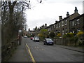
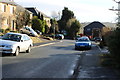
1
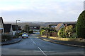
Vickerman Crescent, Taylor Hill
Named after local mill owner.
Image: © Bruce Greenwood
Taken: 25 Jan 2014
0.03 miles
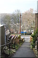
2
Path to Newsome High School
Path from Berry Brow to Newsome High School
Image: © Bruce Greenwood
Taken: 25 Jan 2014
0.05 miles
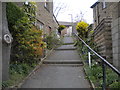
3
Path from Newsome High School to Berry Brow
Looking towards Birch Road, Berry Brow.
Image: © Bruce Greenwood
Taken: 25 Jan 2014
0.07 miles
4
Public footpath off Taylor Hill Road, Berry Brow
Leading to Newsome High School and on to Newsome proper.
Image: © Richard Vince
Taken: 10 Apr 2019
0.07 miles
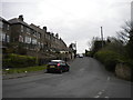
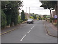
5
South end of Taylor Hill Road, Berry Brow
Image: © Richard Vince
Taken: 10 Apr 2019
0.07 miles
6
North west end of Birch Road, Berry Brow
Seen from the south end of Taylor Hill Road.
Image: © Richard Vince
Taken: 10 Apr 2019
0.08 miles
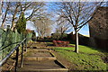
7
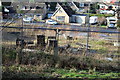
Site of Bankfield House
Mill Owner's house demolished for housing. Remainder of Bankfield Park already developed.
Image: © Bruce Greenwood
Taken: 25 Jan 2014
0.08 miles
8
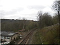
Railway line north west of Berry Brow station (2)
Looking towards Huddersfield from the bridge carrying Station Lane across the railway. The name of the road refers to the old station, which was the other side of the bridge and was demolished long ago. The current station is a little way further to the south east.
Image: © Richard Vince
Taken: 10 Apr 2019
0.09 miles
10
Caldercliffe Road - Bankfield Park Avenue
Image: © Betty Longbottom
Taken: 25 Jul 2016
0.10 miles