IMAGES TAKEN NEAR TO
Holmcliffe Avenue, HUDDERSFIELD, HD4 7RJ
Introduction
This page details the photographs taken nearby to Holmcliffe Avenue, HD4 7RJ by members of the Geograph project.
The Geograph project started in 2005 with the aim of publishing, organising and preserving representative images for every square kilometre of Great Britain, Ireland and the Isle of Man.

There are currently over 7.5m images from over14,400 individuals and you can help contribute to the project by visiting https://www.geograph.org.uk
Image Map
Images are licensed for reuse under creativecommons.org/licenses/by-sa/2.0
Notes
- Clicking on the map will re-center to the selected point.
- The higher the marker number, the further away the image location is from the centre of the postcode.
Image Listing (81 Images Found)
Images are licensed for reuse under creativecommons.org/licenses/by-sa/2.0
Image
Details
Distance
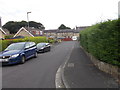
1
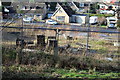
Site of Bankfield House
Mill Owner's house demolished for housing. Remainder of Bankfield Park already developed.
Image: © Bruce Greenwood
Taken: 25 Jan 2014
0.01 miles
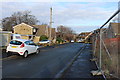
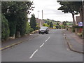
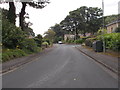
3
Holmcliffe Avenue - Bankfield Park Avenue
Image: © Betty Longbottom
Taken: 25 Jul 2016
0.04 miles
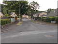
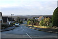
4
Lodge Close - Bankfield Park Avenue
Image: © Betty Longbottom
Taken: 25 Jul 2016
0.06 miles
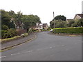
5
Caldercliffe Road - Bankfield Park Avenue
Image: © Betty Longbottom
Taken: 25 Jul 2016
0.07 miles
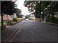
6
Mansion Gardens - Bankfield Park Avenue
Image: © Betty Longbottom
Taken: 25 Jul 2016
0.07 miles
7
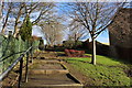
Path to Newsome High School
Path from Berry Brow to Newsome High School
Image: © Bruce Greenwood
Taken: 25 Jan 2014
0.07 miles
8
Pond Close - Bankfield Park Avenue
Image: © Betty Longbottom
Taken: 25 Jul 2016
0.08 miles
9
Bankfield Park Avenue - Taylor Hill Road
Image: © Betty Longbottom
Taken: 25 Jul 2016
0.09 miles
10
Vickerman Crescent, Taylor Hill
Named after local mill owner.
Image: © Bruce Greenwood
Taken: 25 Jan 2014
0.10 miles