IMAGES TAKEN NEAR TO
Armitage Fold, HUDDERSFIELD, HD4 7PA
Introduction
This page details the photographs taken nearby to Armitage Fold, HD4 7PA by members of the Geograph project.
The Geograph project started in 2005 with the aim of publishing, organising and preserving representative images for every square kilometre of Great Britain, Ireland and the Isle of Man.

There are currently over 7.5m images from over14,400 individuals and you can help contribute to the project by visiting https://www.geograph.org.uk
Image Map
Images are licensed for reuse under creativecommons.org/licenses/by-sa/2.0
Notes
- Clicking on the map will re-center to the selected point.
- The higher the marker number, the further away the image location is from the centre of the postcode.
Image Listing (109 Images Found)
Images are licensed for reuse under creativecommons.org/licenses/by-sa/2.0
Image
Details
Distance
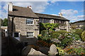
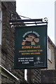
2
Armitage Bridge Monkey Club - Dean Brook Road
Image: © Betty Longbottom
Taken: 10 Nov 2010
0.01 miles
3
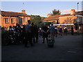
Armitage Bridge village square
Morris dancing troupes 'Slubbing Billy's' of Slaithwaite and 'The Thieving Magpies' of Marsden dancing in the square.
Image: © Craig Mountaine
Taken: 18 Jul 2016
0.01 miles
4
Monkey Club, Armitage Bridge
http://www.geograph.org.uk/photo/5148425
Image: © Ian S
Taken: 5 Oct 2016
0.02 miles
5
Monkey Club, Armitage Bridge
http://www.geograph.org.uk/photo/5148421
Image: © Ian S
Taken: 5 Oct 2016
0.02 miles
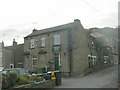
6
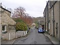
Dean Brook Road - off Armitage Road
Image: © Betty Longbottom
Taken: 10 Nov 2010
0.02 miles
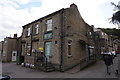
7
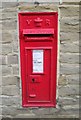
VR Post Box - Armitage Road - junction with Dean Brook Road
Image: © Betty Longbottom
Taken: 10 Nov 2010
0.02 miles
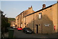
9
Royd Terrace - off Dean Brook Road
Image: © Betty Longbottom
Taken: 10 Nov 2010
0.03 miles
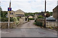
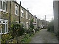
10
Armitage Bridge: Dean Brook Road, leading to Royd Terrace
Image: © Chris
Taken: 10 Sep 2014
0.04 miles