IMAGES TAKEN NEAR TO
Church View, HUDDERSFIELD, HD4 7NY
Introduction
This page details the photographs taken nearby to Church View, HD4 7NY by members of the Geograph project.
The Geograph project started in 2005 with the aim of publishing, organising and preserving representative images for every square kilometre of Great Britain, Ireland and the Isle of Man.

There are currently over 7.5m images from over14,400 individuals and you can help contribute to the project by visiting https://www.geograph.org.uk
Image Map
Images are licensed for reuse under creativecommons.org/licenses/by-sa/2.0
Notes
- Clicking on the map will re-center to the selected point.
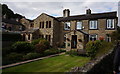
- The higher the marker number, the further away the image location is from the centre of the postcode.
Image Listing (126 Images Found)
Images are licensed for reuse under creativecommons.org/licenses/by-sa/2.0
Image
Details
Distance
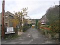
3
Back to the back: back way to Back Armitage Road
Image: © Chris
Taken: 10 Sep 2014
0.02 miles
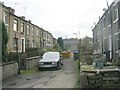
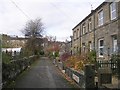
7
Back Armitage Road - Armitage Road
Image: © Betty Longbottom
Taken: 10 Nov 2010
0.03 miles
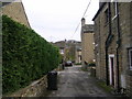
10
Armitage Bridge - cottages and muddy field
The flats on the hill in the background are on Berry Brow. Further into the centre background, Castle Hill is visible.
Image: © Dave Bevis
Taken: 24 Jan 2004
0.04 miles