IMAGES TAKEN NEAR TO
Meltham Road, HUDDERSFIELD, HD4 7BG

Introduction

This page details the photographs taken nearby to Meltham Road, HD4 7BG by members of the Geograph project.

The Geograph project started in 2005 with the aim of publishing, organising and preserving representative images for every square kilometre of Great Britain, Ireland and the Isle of Man.

There are currently over 7.5m images from over14,400 individuals and you can help contribute to the project by visiting https://www.geograph.org.uk

Image Map


Images are licensed for reuse under creativecommons.org/licenses/by-sa/2.0
Notes
  • Clicking on the map will re-center to the selected point.
  • The higher the marker number, the further away the image location is from the centre of the postcode.

Image Listing (51 Images Found)

Images are licensed for reuse under creativecommons.org/licenses/by-sa/2.0
  • ...
Image
Details
Distance
1
Footpath - Meltham Road
Image: © Betty Longbottom Taken: 1 Nov 2010
0.01 miles
2
Lockwood Cemetery - Meltham Road
Image: © Betty Longbottom Taken: 1 Nov 2010
0.04 miles
3
A view from Beaumont Park, Huddersfield
Image: © habiloid Taken: 23 Aug 2022
0.04 miles
4
Lockwood Cemetery Lodge - Meltham Road
Image: © Betty Longbottom Taken: 1 Nov 2010
0.05 miles
5
A view from Beaumont Park, Huddersfield
Image: © habiloid Taken: 23 Aug 2022
0.05 miles
6
Footpath - Meltham Road
Image: © Betty Longbottom Taken: 1 Nov 2010
0.06 miles
7
Old Boundary Marker by the B6108, Meltham Road, Huddersfield
Municipal Boundary Marker by the B6108, in parish of Huddersfield (Kirklees District), Meltham Road, outside 179 Meltham Road, East side of road. Surveyed Milestone Society National ID: YW_HUDSCR01pb
Image: © Milestone Society Taken: Unknown
0.06 miles
8
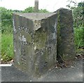
Boundary Stone, Woodfield Road, Lockwood
Just look how much the level of the footway has been raised over the years! On the left, Huddersfield Corporation; on the right South Crosland Township - an obsolete term at the time, one would have expected 'civil parish'. Lockwood joined the Borough of Huddersfield in 1868, although it continued to be a civil parish within the Borough until 1924. This part (Netherton) of South Crosland entered the Borough in 1938. The two 'B's seem to indicate 'boundary'.
Image: © Humphrey Bolton Taken: 11 Jun 2009
0.07 miles
9
Woodfield Road, B6108, Lockwood
This photograph was taken to show the position of the boundary stone Image] but includes on the right a good example of a house in the 'modern' style of the mid-20C, with its windows that go round the corners, and the simple slab projecting over the door to give shelter to callers. It has, however, a hipped roof rather than a flat one.
Image: © Humphrey Bolton Taken: 11 Jun 2009
0.07 miles
10
Cricket Pitch - viewed from Meltham Road
Image: © Betty Longbottom Taken: 1 Nov 2010
0.10 miles
  • ...