Woodfield Road, B6108, Lockwood
Introduction
The photograph on this page of Woodfield Road, B6108, Lockwood by Humphrey Bolton as part of the Geograph project.
The Geograph project started in 2005 with the aim of publishing, organising and preserving representative images for every square kilometre of Great Britain, Ireland and the Isle of Man.

There are currently over 7.5m images from over 14,400 individuals and you can help contribute to the project by visiting https://www.geograph.org.uk
Woodfield Road, B6108, Lockwood
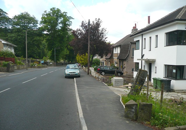
Image: © Humphrey Bolton Taken: 11 Jun 2009
This photograph was taken to show the position of the boundary stone Image] but includes on the right a good example of a house in the 'modern' style of the mid-20C, with its windows that go round the corners, and the simple slab projecting over the door to give shelter to callers. It has, however, a hipped roof rather than a flat one.
Images are licensed for reuse under creativecommons.org/licenses/by-sa/2.0
Image Location
Latitude
53.622382
Longitude
-1.806443